Downloadable Royalty Free, Editable, Digital, Perfect for Creating Sales Territory Maps
Pages
▼
Tuesday, October 27, 2009
How to Color a US State or Country Map in a PowerPoint Slide
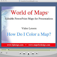
We have had great responses to our How to Videos that we post on bjdesign.com and mapsfordesign.com walking customers through the basic steps of customizing our USA, Canada or World Editable PowerPoint Maps. In this series of posts we are going to break down the Coloring a US State or Country PowerPoint Map video and show you the steps screen by screen. Remember our editable PowerPoint maps also work with Apple Keynote presentation software
You can also view this and all of our How to Customize our Editable PowerPoint Map Videos at www.mapsfordesign.com or www.bjdesign.com
Click to Read Part 1
Part 1. How to Color a US State PowerPoint Map to Set up a Sales Territory
Starting with anyone of our basic editable PowerPoint Maps, US, World, State County, Country, or World Regions, they all work the same.
Click or Select the state or country that you want to color by clicking on it with the mouse pointer. On the PC use the right button of the mouse, on the Mac just click with the mouse.
You can tell something is selected because you will see 8 little boxes or handles appear around the edges, this tells you the object has been selected and you can now do something to it. Make sure you have the Format Pallette or the Drawing Tools Window open.
You can view this video and all of our How to Customize our Editable PowerPoint Map Videos at www.mapsfordesign.com or www.bjdesign.com
Click to Read Part 2
Part 2. How to Color a US State PowerPoint Map to Set up a Sales or Marketing Map
Once you have a state or country selected, (remember you do this by clicking on the state with the mouse pointer) choose a color from the Fill Bucket in the Drawing Tool Bar usually located along the bottom of the PowerPoint slide or on one side.
Or choose a color from the Colors, Weights and Fills option in the Format Palette. If you don’t see it, this Palette it is located in the VIEW pull down menu.
On the new PowerPoint 2007 the fill options are located up at the top in the ribbon, Click on the Colors Button in the Design Tab in the Themes group. The Design Tab appears when an object is selected. Select your color
You can view this video and all of our How to Customize our Editable PowerPoint Map Videos at www.mapsfordesign.com or www.bjdesign.com
Click to read Part 3
Part 3. How to Color a US State PowerPoint Map to Set up a Sales Territory
You have now selected one state or country and filled it with a color. (remember you do this by clicking on the state with the mouse pointer and choosing a color from the Fill Bucket in the Drawing Tool Bar usually located along the bottom of the PowerPoint slide or on one side.
When done deselect by clicking off the image and start on your next state or country.
A couple of tips to help you manage your project:
1. Holding down the Shift Key on your keyboard allows you to select and change several objects at the same time to make the project go faster.
2. Every object in PowerPoint is made up of a fill color and an outline or stroke color, both can be changed independently of each other.
3. When you are done with a section you might Group it together to help you manage your project.
You can view this video and all of our How to Customize our Editable PowerPoint Map Videos at www.mapsfordesign.com or www.bjdesign.com
http://mapsfordesign.blogspot.com/2009/10/how-to-color-us-state-or-country-map-in.html
Wednesday, October 21, 2009
Blank Printable USA 2 Letter State Map
Blank Printable Outline Map of the US with 2 letter state names. Perfect for quickly sketching out some marketing data or a class assignment. This royalty free jpg map is located on our new www.freeusandworldmaps.com site. The home for all kinds of royalty free jpg maps. Including printable blank maps as well as all kind of colored US, World, States, Countries, and World Regions and Globes.
To learn more click here for www.freeUSandWorldMaps.com
Tuesday, October 13, 2009
Maps for Design.com Editable PowerPoint Maps
After a brief break we have relaunched our single downloadable editable Powerpoint clip art map site, MapsforDesign.com. The site carries a full line of editable PowerPoint maps for sales and marketing presentations, illustrations, web sites and classroom projects. Containing PPT maps of the World, US, States, Counties, World Regions, Countries and Globes. The site has a new look, is more efficient and will have an expanded collection of maps. Along with all the new features we have added the full line of our "How To Customize" videos to the site. Maps can be purchases individually for your projects. You can also purchase a CD if you wanted the entire collection.
If you need more than three PowerPoint maps we recommend you use our subscription site www.bjdesign.com where you can download as many maps as you want for one fixed price. Either way we have got you covered. BJDesign also carries the full line of Adobe Illustrator and jpg maps.
For an individual map, http://www.mapsfordesign.com
If you need lots of maps, http://www.bjdesign.com
Saturday, October 3, 2009
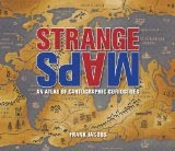
Strange Maps: An Atlas of Cartographic Curiosities
Well now here is a interesting new book coming out later this month. Sounds like it might be a lot of fun, the book is based off of the Strange Maps blog by Frank Jacobs
Spanning many centuries, all continents, and the realms of outer space and the imagination, a collection of 138 unique graphics combining beautiful full-color illustrations with quirky statistics and smart social commentary. The result is a distinctive illustrated guide to the world. Categories of cartographic curiosities include: • Literary Creations, featuring a map of Thomas More's Utopia and the world of George Orwell's 1984
Check it out at Strange Maps: An Atlas of Cartographic Curiosities
Also check out the Strange Maps blog
Spanning many centuries, all continents, and the realms of outer space and the imagination, a collection of 138 unique graphics combining beautiful full-color illustrations with quirky statistics and smart social commentary. The result is a distinctive illustrated guide to the world. Categories of cartographic curiosities include: • Literary Creations, featuring a map of Thomas More's Utopia and the world of George Orwell's 1984
- Misconceptions, such as a lavish seventeenth century map depicting California as an island
- Political Parody, containing the "Jesusland map" and other humorous takes on voter profiles
- Whatchamacallit, including a map of the area codes for regions where the rapper Ludacris sings about having "hoes"
- Obscure Proposals, capturing Thomas Jefferson's vision for dividing the Northwest Territory into ten states with names such as Polypotamia and Assenisipia
- Fantastic Maps, with a depiction of what the globe might look like if the sea and land were inverted
Check it out at Strange Maps: An Atlas of Cartographic Curiosities
Also check out the Strange Maps blog
Friday, October 2, 2009
Focus on Europe Day, Scandinavia
Well it is starting to get cold and fall is fast approaching, leaves will be turning soon. We were thinking of Europe and our attention drifted up to the Scandinavian countries, Norway, Sweden Finland and Denmark. We had produced this editable PowerPoint and illustrator maps a while back and thought it was time to bring it back out again.
Keep your attention to the blog, our MapsforDesign.com site is about to be relaunched, new shopping cart, easier to navigate, and a tighter focus on PowerPoint map for presentations. We have been working away on it for the past several months. In the mean time all of our maps are available at our subscription site, www.bjdesign.com for any of your projects. Remember we love questions so ask away.