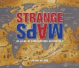
 Well now here is a interesting new book coming out later this month. Sounds like it might be a lot of fun, the book is based off of the Strange Maps blog by Frank Jacobs
Spanning many centuries, all continents, and the realms of outer space and the imagination, a collection of 138 unique graphics combining beautiful full-color illustrations with quirky statistics and smart social commentary. The result is a distinctive illustrated guide to the world. Categories of cartographic curiosities include: • Literary Creations, featuring a map of Thomas More's Utopia and the world of George Orwell's 1984
- Misconceptions, such as a lavish seventeenth century map depicting California as an island
- Political Parody, containing the "Jesusland map" and other humorous takes on voter profiles
- Whatchamacallit, including a map of the area codes for regions where the rapper Ludacris sings about having "hoes"
- Obscure Proposals, capturing Thomas Jefferson's vision for dividing the Northwest Territory into ten states with names such as Polypotamia and Assenisipia
- Fantastic Maps, with a depiction of what the globe might look like if the sea and land were inverted
Check it out at Strange Maps: An Atlas of Cartographic Curiosities
Also check out the Strange Maps blog
No comments:
Post a Comment