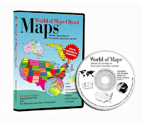
We have a special promotion going on where you can purchase for one price the Top 10 PowerPoint maps that we sell. PLUS this package also includes a FREE copy of our entire World of Maps Collection CD-Rom with over 2,000 maps in PowerPoint, Adobe Illustrator and jpg formats. Yes this is our regular CD collection that we are offering with this special promotion. Also included on the disc is our new publication "How to Customize PowerPoint Clip Art Maps." The PowerPoint Top 10 map package you download right away so you can start working on your project, the CD will be mailed to you by US Priority Mail, shipping is free anywhere.
All map elements are royalty free and editable including the States, Countries and Text Names. This package includes our most popular maps. The special download PowerPoint package includes:
• USA with 2 Letter State Names
• USA with Full State Names
• USA and Canada
• USA Major Highways
• USA Major Cities, Capitals
• Canada
• Europe
• North America/USA/Canada/Mexico
• World Mercator with Countries & Names
• World Robinson with Countries
To learn more and see what is included click and jump over to our Special Top 10 PowerPoint Maps Promotion page on the MapsForDesign.com site.
No comments:
Post a Comment