Customer Question: Are there any tips to help with enlarging or reducing a group of several states?
Our Answer: The basic key for enlarging or reducing several states is to use the grouping feature. Using your mouse pointer, hold down the shift key and select the states you want to enlarge or reduce. Holding down the shift key allows you to select several states at the same time, it also allows you to keep things proportional when you resize. Then select Group.
After grouping, you will see 8 handles around your object. With your pointer select one of the corner handles, hold down the mouse button and drag out or in, in a 45 degree direction to resize. After you have the size you want you can then ungroup. Text doesn't scale but it does move to the correct position. Before ungrouping resize the text using the general text size box located up in the top, then ungroup.
We have a series of videos that address this very topic. Please check this link. Customers have found them very helpful. Please feel free to contact us with any additional questions.
Downloadable Royalty Free, Editable, Digital, Perfect for Creating Sales Territory Maps
Wednesday, April 29, 2009
Thursday, April 23, 2009
World of Maps CD and Maps Can Be Used on More Than One Computer
Customer Question: Can you use the CD and or the individual editable clip art maps on more than one computer, say at home and at the office?
Answer: You can use the CD on any computer, any time, any where, we put no limits on it. You can also share the maps within your work group in fact we encourage this. We ask that if you have needs in different offices, say in different cities, then we hope you buy a license but in your work group no problem. We want you to be able to do your job.
Answer: You can use the CD on any computer, any time, any where, we put no limits on it. You can also share the maps within your work group in fact we encourage this. We ask that if you have needs in different offices, say in different cities, then we hope you buy a license but in your work group no problem. We want you to be able to do your job.
USA and Canada Editable PowerPoint and Illustrator Maps
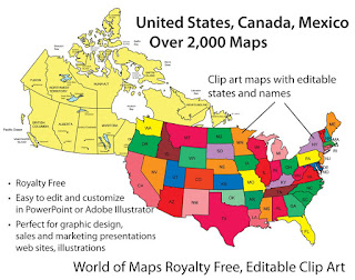
 We offer a great collection of editable USA and Canadian maps. All maps are royalty free and fully editable in either PowerPoint or Adobe Illustrator, on our CD Rom or on www.bjdesign.com we also have jpg color and black and white versions of all the maps. All of the states, provinces and text are editable and can be changed, colored, moved around or even removed. Maps can be purchased on by subscription on www.bjdesign.com, or individually on www.mapsfordesign.com and at both you can pick up a CD-Rom.
Wednesday, April 22, 2009
Any Special Software Needed for Using the World of Maps Editable Clip Art Maps
Customer Question: What programs do you need to use your clip art editable maps?
Answer: They are just clip art maps in different formats. You just need to have MS PowerPoint for the PowerPoint maps, any version, or Adobe Illustrator for the Illustrator ones, and then any photo editing software like Adobe Photoshop for the jpg ones. Most people have at least one of these program and you can go from here.
Answer: They are just clip art maps in different formats. You just need to have MS PowerPoint for the PowerPoint maps, any version, or Adobe Illustrator for the Illustrator ones, and then any photo editing software like Adobe Photoshop for the jpg ones. Most people have at least one of these program and you can go from here.
Sunday, April 19, 2009
Top 10 PowerPoint Maps in a Special Promotion

We have a special promotion going on where you can purchase for one price the Top 10 PowerPoint maps that we sell. PLUS this package also includes a FREE copy of our entire World of Maps Collection CD-Rom with over 2,000 maps in PowerPoint, Adobe Illustrator and jpg formats. Yes this is our regular CD collection that we are offering with this special promotion. Also included on the disc is our new publication "How to Customize PowerPoint Clip Art Maps." The PowerPoint Top 10 map package you download right away so you can start working on your project, the CD will be mailed to you by US Priority Mail, shipping is free anywhere.
All map elements are royalty free and editable including the States, Countries and Text Names. This package includes our most popular maps. The special download PowerPoint package includes:
• USA with 2 Letter State Names
• USA with Full State Names
• USA and Canada
• USA Major Highways
• USA Major Cities, Capitals
• Canada
• Europe
• North America/USA/Canada/Mexico
• World Mercator with Countries & Names
• World Robinson with Countries
To learn more and see what is included click and jump over to our Special Top 10 PowerPoint Maps Promotion page on the MapsForDesign.com site.
Any further Maintenance for Using the World of Maps Editable Clip Art Maps
Customer Question: And do you have to buy maintenance on the CD-ROM to continue using it?
Answer: There is no maintenance on our product. They are just clip art maps in different formats. Pretty simple stuff.
Answer: There is no maintenance on our product. They are just clip art maps in different formats. Pretty simple stuff.
Friday, April 17, 2009
How to Customize PowerPoint Map Videos Are Up

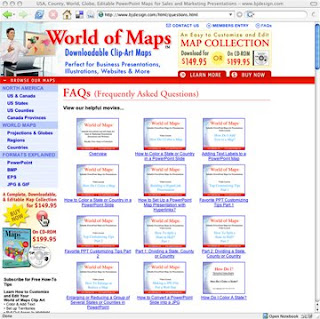
Our How to Customize PowerPoint Clip Art Maps videos are up for viewing on our World of Maps site at www.bjdesign.com. We have them loaded in our Frequently Asked Questions section. Videos include: How to Color, How to Add Text, Split a State in Half, Group and Ungroup, Build a Sales Territory, the entire set. To view you can go over to www.bjdesign.com and they are on the FAQ page or click this link.
Thursday, April 16, 2009
Is the CD version of World of Maps a Stand Alone Disc?
Customer Question: If we buy the CD-ROM, do we still have to go online to use the product?
Answer: You do not have to go on line to use our CD, it is a stand alone product, it does not have any special security and can work on any PC. On www.bjdesign.com we offer a unlimited download subscription option for our maps and the CD is for backup of what you see on the site. On www.mapsfordesign.com, our site for picking up a single map, the CD is a backup of the online collection and is perfect if you have a need for more than 4 or so maps. The CD is a back up of everything, plus some additional material like the CIA World Fact Book Collection of maps and flags and our jpg collection of maps.
Answer: You do not have to go on line to use our CD, it is a stand alone product, it does not have any special security and can work on any PC. On www.bjdesign.com we offer a unlimited download subscription option for our maps and the CD is for backup of what you see on the site. On www.mapsfordesign.com, our site for picking up a single map, the CD is a backup of the online collection and is perfect if you have a need for more than 4 or so maps. The CD is a back up of everything, plus some additional material like the CIA World Fact Book Collection of maps and flags and our jpg collection of maps.
Wednesday, April 15, 2009
How Does the CD Version of the World of Maps Work?
Customer Questions: What is on the CD-Rom version of your World of Maps collection.
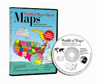
Answer: Our CD is a backup of the entire collection. It has PowerPoint, Adobe Illustrator and JPG versions of every map. Along with our own maps is included the CIA World Fact Book maps collections and many other maps. A lot of our customers buy the CD when they are working on large projects that require a lot of maps or are traveling and need constant access, or just want a backup. The CD is available on both of our sites and now on Amazon.com
Answer: Our CD is a backup of the entire collection. It has PowerPoint, Adobe Illustrator and JPG versions of every map. Along with our own maps is included the CIA World Fact Book maps collections and many other maps. A lot of our customers buy the CD when they are working on large projects that require a lot of maps or are traveling and need constant access, or just want a backup. The CD is available on both of our sites and now on Amazon.com
Monday, April 13, 2009
World of Maps Country Map, France

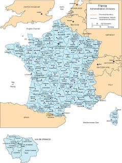
Map of France with all of the provinces and administrative districts, including captials of each. Available in both PowerPoint and Adobe Illustrator formats. This is one of over 90 world country maps in our collection of editable clip art maps. Check out our subscription site with unlimited download www.bjdesign.com to see more
Setting up Sales Territories with a Second Requirement
Customer Question: How do I set up not only a sales territory but also exclusive and nonexclusive reseller territories on top of this?
Answer: Thank you for visiting our site and for your question. I am not sure how you have your information and how much of it over laps each state. You do have the ability in PowerPoint to add more than one fill color to a state or country. This is usually done as a pattern and is located in the Fill Effects in the Fill pop up menu. You could have on color for each person and then two second colors, one for each exclusive and the other for nonexclusive. I would also set up a key on the side to help the viewer understand what is going on.
Answer: Thank you for visiting our site and for your question. I am not sure how you have your information and how much of it over laps each state. You do have the ability in PowerPoint to add more than one fill color to a state or country. This is usually done as a pattern and is located in the Fill Effects in the Fill pop up menu. You could have on color for each person and then two second colors, one for each exclusive and the other for nonexclusive. I would also set up a key on the side to help the viewer understand what is going on.
Adding Multiple Cities to a USA or World Map
Customer Question: I have a subscription to your editable World of Maps collection and I work with the US State and the World Country maps a lot. One of the challenges I have is adding cities in geographically correct locations – especially as it relates to a country. It is a tedious process, do you have any ideas or methods to help me do it quicker.
Answer: Great question, one of the ideas we had when building our maps was to keep them pretty simple, to make them basic outline maps that are easy to customize for the wide variety of uses people have. Our maps aren’t set up with any database abilities but PowerPoint or Adobe Illustrator are powerful programs and you can add whatever you need.
The basic way to do would be to find a regular State or Country map that already has the cities you are looking for on it. The best place to find this is Google Maps or Google Images. Google Images is one of the navigation button on the main Google screen, you can search on the map in question. Hundreds will come up. I look for a map that is 50K or more in size and save it to my computer.
This map is then brought into PowerPoint or Illustrator using the Insert or Place commands and is sized and turned to approximately fit the outline of your existing state. You are basically use the image from Google as a template to locate your cities. You can use the shapes or drawing tools to draw small city dots and you can place them over the cities on the map graphic. Add city names, when finished delete the state or country graphic. Once you get the hang of it the process moves pretty quickly.
Don't forget, blog readers get a special 20% discount on our Maps for Design editable PowerPoint and Illustrator maps, any number of maps, any item, including the CDs, simply enter the coupon code: "MapBlog" during checkout to receive. Discount good till 12/31/2009.
Friday, April 10, 2009
How to Split a State or Country in Half
Customer Question: Can I cut two States in half to show sales and marketing territories, is that possible with your editable PowerPoint or Adobe Illustrator royalty free clip art?
Answer: Yes you can split a state in half. If you are using our Adobe Illustrator clip art it is pretty straight forward. You use the scissor tool and cut the lines, you then use the line tool and rejoin the parts and fill them.
If you are using PowerPoint it isn’t possible to cut the state border lines, but we have figured out two work arounds for this. We have set up a web site with How to Videos where this is explained, also if you sign up for our Tips lessons you can download the How to Book.
If you go to this site : http://mapsfordesignhowto.blogspot.com/
To put it simply you can split the state but you can make it look like you did by overlaying a piece of the state on top of the existing state and coloring it. With simple outline states like Colorado you can just trace the border with the drawing tool. With more complex state outlines like California you copy the state and then nibble away the points with the edit points tool. Add a new color, lay it on top and to the viewer it looks like the state has been split in half.
Sunday, April 5, 2009
Our Maps are Great for Making Blank, Printable, Outline Maps
We get this question from customers all the time,
so we pulled together a short video on the topic:
Can your maps be used for making a blank, printable, outline map
and will the lines be sharp and clear?
Watch the video above to see the demonstration.
Our maps work great for producing blank outline maps. Our editable
maps print out of either PowerPoint or Adobe Illustrator with nice
sharp clean lines because all of the objects are produced with
vector lines. No bitmap lines here. The maps are easy to make,
just select the entire map and fill with white. I usually recommend
adding white because you can then select an individual state if you
want without trying to grab the line.
So change the fill to white, adjust your line weight if you want,
enlarge or reduce to the correct size and print.
Depending on your printer you can also scale to any size.
Whether you are using our Editable PowerPoint maps or our Adobe
Illustrator clip art maps, it is easy to produce a clean blank
printable outline map.
Subscribe to:
Comments (Atom)