Showing posts with label How To Edit PowerPoint Maps Video. Show all posts

Saturday, August 10, 2013

Editable PowerPoint Virginia County Map

We had a nice question come in about our editable PowerPoint maps, I made up a short video answer

Question
Do the US county maps include main interstates and highways?  Can you enter more data in a specific county other than the county name?   My goal is to have a county map with county names, main highways/interstates, be able to color code the counties and add a number to each county.
Looking for a state county map with county names and main roads.

Answer
We have a nice collection of editable county maps. This short video highlights our Virginia editable county PowerPoint map and all of its features.


Our county maps include 4 slides, Land and Text, just the Land, just the Text and a fourth with the major interstates and cities. All element are editable and can be changed. You can learn more about our maps at http://www.mapsfordesign.com

Saturday, September 29, 2012

How to Make a Blank Canada Map in PowerPoint

We get asked this question fairly often on how to use our editable Powerpoint maps to make up blank map copy master for a school worksheet or presentation. It is real easy to do and this short video will take you through the steps


It is easy to make a blank, printable, outline Canada for marking up, coloring, school project, whatever you need from our royalty free downloadable PowerPoint clip art maps. Watch the video to learn how to take a basic World of Maps map, select it and change the colors to have a map with sharp, clean vector lines for your project. It is very easy to produce a clean blank printable map.

1. After purchasing and downloading our editable PowerPoint mapyou're your project, open it in PowerPoint. For our example we are using a Canada map.

2. Select the map with your pointer by clicking in the upper left corner of the slide and dragging the pointer over the entire map so that it is completely surrounded by the light blue field. Once you release you finger all the land will be selected. You can also do this by choosing Select All in the Edit pull down menu. You can also hold the SHIFT key and select each province individually.

3. Once everything is selected you can go to the Formatting Palette or up in the Ribbon -- Colors, Weights, and Fills and choose the Fill Bucket and fill the map with the color white. I like using the white fill instead of nothing because it is easier to select a province with color in it if you want to customize it later. If you have no fill you have to grab the line to select it, with a color fill you can click anywhere on the state to select it. That is it, you are ready to go, save it and print it, pretty easy.

TIPS:
4. If you group the map you can also resize it, (check out our enlarging and reducing video) and make a custom map.

5. I usually recommend removing the text first but if you don't then just hold down the shift key and select each state or county individually and then fill with color.

To see all of our How-To videos checkout the Instructional Video Page on our MapsforDesign.com site:  http://www.mapsfordesign.com/Instructional-Videos.html

Tuesday, September 18, 2012

Republic of Ireland Map produced for a customer

We had a request from on of our World of Maps customers from www.bjdesign.com for a PowerPoint map of Ireland for a customer who was setting up sales territories. We have included that map in our Great Britain map all along but didn't have it as a separate map. Not sure why that happen, but sometimes things get over looked. The customer asked about an individual one, so easy enough to make up. I took the Great Britain map and deleted the UK parts and then enlarged the Ireland side, fixed the text a little and there you are. Our maps are pretty flexible and easy to change. Once done I sent the map off to the UK for the customer. We received back and very comment and I am glad to help.

Here is the comment, thank you very much, we love comments and we love finding out where we have holes in the collection. I will get this new map into the collection.

"Bruce, that's fantastic, thank you!
We use your maps every day when selling territories. Best maps we've ever bought!"

Paul

Republic of Ireland and Northern Ireland, editable PowerPoint Map


Monday, July 23, 2012

Map Monday Video • US National Country Map with Names in PowerPoint


It is time for our Map Monday Video so on to a question that came into our comment box, people send us all kinds of questions and we love to get them.

Today's question comes a viewers boss and the question is do you have an editable national US County PowerPoint map with all of the names listed on the map.

Answer:
So they're asking about our USA National County editable PowerPoint map. This is the map the entire national US County editable PowerPoint map. This map is in PowerPoint and it has all the counties in United States all 3120 of them and also has all of their names on it.

So lets bring that map up here in PowerPoint so you can see that. So this is a fully editable National US map of all the counties in PowerPoint, all 3120 of them in United States. So if I click on it let's say the state of Maine, lets zoom in here and I can select this state and go to my formatting palette and choose another color. We can change this orange color to say a yellow color. I still have the entire state grouped so it all changes to one color, but everything in this state is a separate editable County. The state of Maine is made up of individual county maps and I can go and ungroup it in PowerPoint and work each individual county. I go to the draw toolbar and I can just click right here and I can now see all the individual counties are separate objects. I can color each individual object and fill it with its own color.

So that's what people are asking about, that can they change these things, are they editable but what they are really looking for is are there names on all of these counties. Because this is a big map with a lot of names and a lot of counties and they wanted to go in there and find their specific County and make the changes. So yes we have a US national County map with all the usual counties and that we also have a version with names on it. The name version isn't on the site but we can send you that our version if you purchase of the regular County map. It is a pretty big file so we just email it to you rather than set up for download like all the others.

So not only can you change all the individual counties and the colors but also the text you just have to ungroup it is we have it group by state can keep it organized. Each one of those names can be change, formatted differently, deleted or moved around or whatever it is you want to do.


Here is the link for the actual map on MapsForDesign.com
http://www.mapsfordesign.com/US-National-County-Editable-County-PowerPoint-Map-for-Building-Regions.html

We have lots of customers go in and customize this map especially when they have a need for a general territory map that's crossing state lines. There are much more sophisticated maps out there that are tied to a database, we don't have that. Our map is all done by hand but it works pretty well when you need to set up a basic territory map.
We also have individual state county maps in PowerPoint.

The slide package also includes a version of the map with names, without names, on a blank map with just names, and also a state outline map that can be laid on top to give you a nice borders.

For More Information, These maps are located on both of our sites on
http://www.BJDesign.com our subscription site
http://www.Mapsfordesign.com our site for individual maps

Monday, July 16, 2012

How to Add Cities and Location Dots to Our Editable PowerPoint Maps


We had a great question from a customer on how to add new cities and location dots to our PowerPoint or Adobe Illustrator maps. This is pretty easy to do using either a text bullet or drawing a small circle and then a text box for the name. I also thought this would make a great video as we get this question now and then.

We love customer questions, please let us know what you need to know and we make up a video on the question.

Thursday, May 12, 2011

Plotting Locations on PowerPoint Maps

A question we get a lot is about can you plot store locations, third party sites, sales offices etc. on our maps.

The answer is yes it is very easy. Our PowerPoint maps are fully editable and they are easy to color, add text, move stuff around. They make a great solution for sending out info on your locations. PowerPoint files email very easily and can be opened by almost anyone in the business world.

You can put little stars or boxes, color them, make them any size, they are easy to move around. If you need to add text, just use the text tool, type what you want, format it and then put it where you need.

Take a look at our How Do I Add Text to a PowerPoint Map video for some additional info. I am going to see if I can grab a moment and do an additional video on this topic.

Saturday, October 2, 2010

Overview Video for Our Editable PowerPoint, Royalty Free Clip Art Maps for Presentations

 
Royalty free, downloadable, editable clip art maps, perfect for setting up sales and marketing presentations, showing sales territories, office locations, defining regions and project progress. Maps are also great for illustrations, websites, education, school projects, home schooling and scrapbooking.

Includes a full range of World maps, USA maps, 50 US States plus territory maps, 50 State County maps, Canada maps and Provinces maps, World Regional maps with editable countries, over 90 individual countries including United States maps, Canada maps, United Kingdom maps, India map, Australia map, and many more.

Each immediately downloadable states, county, or country map, is an individual element that can be easily edited, modified, customized, resized, changed, colored however you like or deleted, group or setup a custom map. All text blocks are live text that can be edited and changed. Easy to make a blank or printable maps for schoolor other projects, just remove the color. All maps come loaded right in a PowerPoint slide for easy editing and work with all the PowerPoint tools. Our editable clip art maps work with all version of PowerPoint on PCs or Macintosh, and with Apple's Keynote presentation software

You can see all of our new How to Edit our PowerPoint maps videos on our editablemaps YouTube Channel

Monday, September 6, 2010

12 New How-to Videos for MapsforDesign Editable PowerPoint Maps


We have been quiet but quite busy lately here at the World of Maps. We have been redoing all of our How-To Videos for editing and customizing our editable PowerPoint Maps for MapsForDesign.com. Reworking each one to clean it up, update for PowerPoint 2007, and give everyone better instructions one how to do the different tasks. It has taken a while but we are done and they are now up on YouTube and will shortly be up on the MapsforDesign.com instruction page.

Some of the thing we did were simplified each video-"One Video/One Idea, aka Ed Dale," rewrote the YouTube and website text, new graphics, consistent look across all videos, beefed up the keyword research for better tags and helping customers find what they need, improved the titles and really worked enhancing the YouTube page. The goal was to have it all done for Labor day so that we can turn the videos over to our web master and he can connect them all to the site. Over the next couple weeks we will post each one here also.

You can visit the YouTube channel at http://www.youtube.com/user/editablemaps and see all the new videos

Let us know what you think and are some more videos we should be pulling together.

Thursday, November 5, 2009

5 More How to Instruction Videos for Customizing PPT Maps

In our previous instructional video list we highlighted some of our popular videos. This post continues with some more videos on customizing our editable World of Maps PowerPoint maps. These videos can be watch at www.mapsfordesign.com or www.bjdesign.com

6. Setting Up a Country Sales and Marketing Territory. Our editable PowerPoint county maps are very popular for highlighting a sales territory for people. We sell our maps to many sales and marketing managers and this is a very common request. Can I set up a simple territory map for my sales people. Our maps work great for this and this video walks you through the sets. View this video.

7. How to Divide a PowerPoint Clip Art Map In-half. This video covers one of our most asked questions. How to divide a state or county in half. Very ofter a state is covered by more than one sales rep and the manager needs to show this. PowerPoint isn't really a graphic program but we have come up with a number of techniques to do this.

8. How to Enlarge or Reduce an Object in PowerPoint. A common problem is that you have highlighted several states or counties for a presentation but they aren't big enough in the slide. This video shows you how to do this, bigger or smaller.

9. Printable, Blank, Outline USA and World Maps. We sell mostly PowerPoint and Illustrator maps with colors in them ready to go. But alot of people use blank maps that they can mark up and draw on. Our maps are great for doing this if you just remove the color. Plus most blank printable maps you find on the web can't be customized for your project. Ours, using PowerPoint which almost everyone has, can easily be. Remove the color and print it out. This video walks you through the steps, view it on YouTube.

10. This is a two part video, Favorite PowerPoint Customizing Tips, Parts 1 and 2. We have learned a lot over the years using our maps. In these two videos we release this info. We talk about Grouping and Ungrouping, using the Shift Key, and in Part 2 Enlarging and Reducing and the Snap to Grid feature.

Hope you enjoy them and find them useful. Let us know of any questions you have, maybe we will make it into a video.

Friday, April 17, 2009

How to Customize PowerPoint Map Videos Are Up


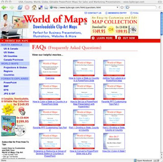
Our How to Customize PowerPoint Clip Art Maps videos are up for viewing on our World of Maps site at www.bjdesign.com. We have them loaded in our Frequently Asked Questions section. Videos include: How to Color, How to Add Text, Split a State in Half, Group and Ungroup, Build a Sales Territory, the entire set. To view you can go over to www.bjdesign.com and they are on the FAQ page or click this link.

Monday, December 22, 2008

Easy to Edit Countries and Text Names

Customer Question: I would like to add text to to some of your country maps. How editable are your maps?

Answer: All of our powerpoint maps are editable, just like any PowerPoint slide is. You can add text where ever you like. Just use the text tool in the drawing bar. Once you have type in place you can format and move where ever you need. We have a lot of samples on the site that you can also download and try out. Also check out our How to Videos on customzing maps, they will show you just how to do this.

Thank you for stopping by.

Saturday, October 18, 2008

Coloring a State or Country in a PowerPoint Slide

Today’s lesson from Maps for Design is about coloring map elements in your PowerPoint Clip Art Maps.

1. Click or Select the state or country that you want to color with the mouse pointer by clicking on it. On the PC use the right button of the mouse, on the Mac just click with the mouse.

You can tell something is selected because you will see 8 little boxes or handles appear around the edges, this tells you the object has been selected and you can now do something to it.

2. Choose a color from the Fill Bucket in the Drawing Tool Bar usually located along the bottom of the PowerPoint slide. Or choose a color from the Colors, Weights and Fills option in the Format Palette. This Palette is located in the VIEW pull down menu.

3. When done deselect by clicking off the image and start on your next one.

TIP. Holding down the Shift Key on your keyboard allows you to select and change several objects at the same time to make the project go faster.

Every object in PowerPoint is made up of a fill color and an outline or stroke color, both can be changed independently of each other.

Video
To review our How To Videos please click this link or copy it into the address section of your web browser.
http://mapsfordesignhowto.blogspot.com/

Tuesday, March 11, 2008

How to Add Text to a PowerPoint Map Slide

How to Video showing how to add text to a PowerPoint clipart state or county map slide.

To add text select the TEXT INSERTION tool in the DRAWING TOOL BAR, usually located along the bottom of your slide window. Click anywhere on the slide and begin typing.

Use the FORMATING PALLET or the pull down menus at the top or your screen to customize with fonts, size, and color. Text blocks can be moved around the screen by clicking, holding and dragging on the grey box that surrounds the text. This box is visible after you have clicked on the text.

To delete a text box, select is with the pointer and then click on the gray box surrounding the type. Hitting the DELETE key on your keyboard will delete the text.

Our maps can be completely edited in PowerPoint. Every state, county, country or text block is an individual editable element. They can be colored, customized, move or deleted elements as you want. PowerPoint has a very nice collection of editing and drawing tools, located either along the bottom or along the side of your screen.

How to Divide a PowerPoint Map In-half

How to Video showing how to divide a PowerPoint clipart state or county map into two territories and color them differently. PowerPoint isn't really a drawing program but we have found a fairly effective way of doing this. Below are two ways to handle this.

The first is to copy the state and paste it right on top or on the side so that you can work on it. Go to the DRAW Pop Up menu in the Tool Bar and select EDIT POINTS, you will see all of the drawing points or handles. You then click on each point with the mouse pointer, while you hold down the Control key on the PC or the Option key on the Mac, the selected point will then disappear. You work your way nibbling around the area you want to delete. You end up at some point with a part of a state. Give it its own color and stroke or line and place it on top of the other map. And presto you have a state that looks to the viewer like you have cut it in half. But in reality is made up of two pieces, a full state and half state.

A second way is to use one of the line tools (I like the one that just uses straight lines) and zoom in to 400% and trace over the outline of the state with the drawing tools. Moving around it, tracing the shape of the state and just the part you want to keep. Give it a color and now you have again what looks like a state cut in half.

The drawing tools are located in the AUTO SHAPES pop up menu in the DRAWING TOOL BAR. In AUTO SHAPES select LINES, (we like the middle line on the bottom row, the FREE FORM LINE tool). With this line tool selected you can now trace over the map, making a complete closed path by clicking point by point around th edge. Bring the line back to the beginning point and give two quick clicks and you will have an object that can be filled with a new color.

To make this easier locate the Zoom Box in the upper right hand corner of the top tool bar and select 300 or 400% so you can really see what is going on. If you need to you can adjust the points by selecting the new object with your pointer and choosing EDIT POINTS from the DRAW popup menu on the far left of the tool bar. Also make sure SNAP TO GRID is not checked. This method isn't perfect but will work pretty well and allows you to set up the partial territories.

If you are using the EPS Adobe Illustrator version of our maps you can use the SCISSORS tool and cut the border and then re-join the lines giving you two halves.

How do I Enlarge or Reduce an Object in PowerPoint?

How to Video showing how to enlarge or reduce a group of clipart state, country or county PowerPoint map.

To enlarge several states or counties you need to GROUP them together.
1 Hold down the Shift key and using the pointer CLICK using the right button on the PC mouse and the regular click on the Mac mouse, on the states you want to enlarge together.

2 Once the states are selected click on the DRAW popup menu in the TOOL BAR along the bottom and choose GROUP.

3 You will now see just 8 handles on your selected group. Place your pointer over one of the lower left or right corner handles. Click, and hold down the mouse button and drag the handle in a diagonal 45 degree direction. This will enlarge the group. Release your mouse button when you have the correct size. Pulling out, the group will enlarge, moving in towards the center it will reduce. Holding down the SHIFT key will keep things proportional.

4 Text elements will need to be re-adjusted manually, they will move to the correct place but in PowerPoint they do not scale up or down. You may also need to UNGROUP them and move them where needed. The text can be resized using the Font Tools along the top of the screen.

How To Color a State, County or Country in PowerPoint

How to Video for coloring an editable PowerPoint clipart map .

Select the state or country with the pointer by clicking on it. On the PC use the right button of the mouse, on the Mac just click with the mouse. You will see 8 little handles appear around it, this tells you the object has been selected. Choose a color from the Fill Bucket in the Drawing Tool Bar usually located along the bottom of the PowerPoint slide.

Monday, March 10, 2008

Learn More About Our Maps

Editable MS PowerPoint and EPS clipart maps for sales and marketing presentations, illustrations, and websites. Royalty Free, World, USA, States, County, Countries, World Regions, and Globes.

Each state or country is an individual element that can be customized, changed, colored however you like.

Perfect for sales and marketing presentations, showing sales territories, advertising, graphic design, building maps for websites, anywhere a royalty free map is needed

Visit our www.mapsfordesign.com website for more info