Editable PowerPoint Canada Map with Provinces and Territories
Canadian PowerPoint Map with 10 provinces and 3 territories. Each map comes with editable province names, capitals, major cities. Easy to color and edit, add text or images. Alberta, British Columbia, Manitoba, New Brunswick, Newfoundland, Labrador, North West Territories, Nova Scotia, Nunavut, Ontario, Prince Edward Island, Quebec, Saskatchewan, Yukon Territory, includes Great Lakes and other lakes.
Canada Powerpoint Map with Editable Provinces, Territories & NamesThis map is available to Download in an editable PowerPoint format from MapsForDesign.com. Easy to color, customize, add text, delete sections. To learn more of purchase a Canada map, please click MapsforDesign.com
We are please to announce our new Map Resources Page on our MapsForDesign blog. This resources includes clip art and map presentation websites, PowerPoint slide templets, icons and other resources to help you create your presentations.
Included are
• Clip art map sites for presentation, graphic design, web, education, antique and historical maps
• Flash maps for building interactive website maps
• Software for setting up sales and territories and marketing map
• Zip code maps
• Antique and historical maps resources and websites
• PowerPoint slide templates websites, including sources for icons and map markers
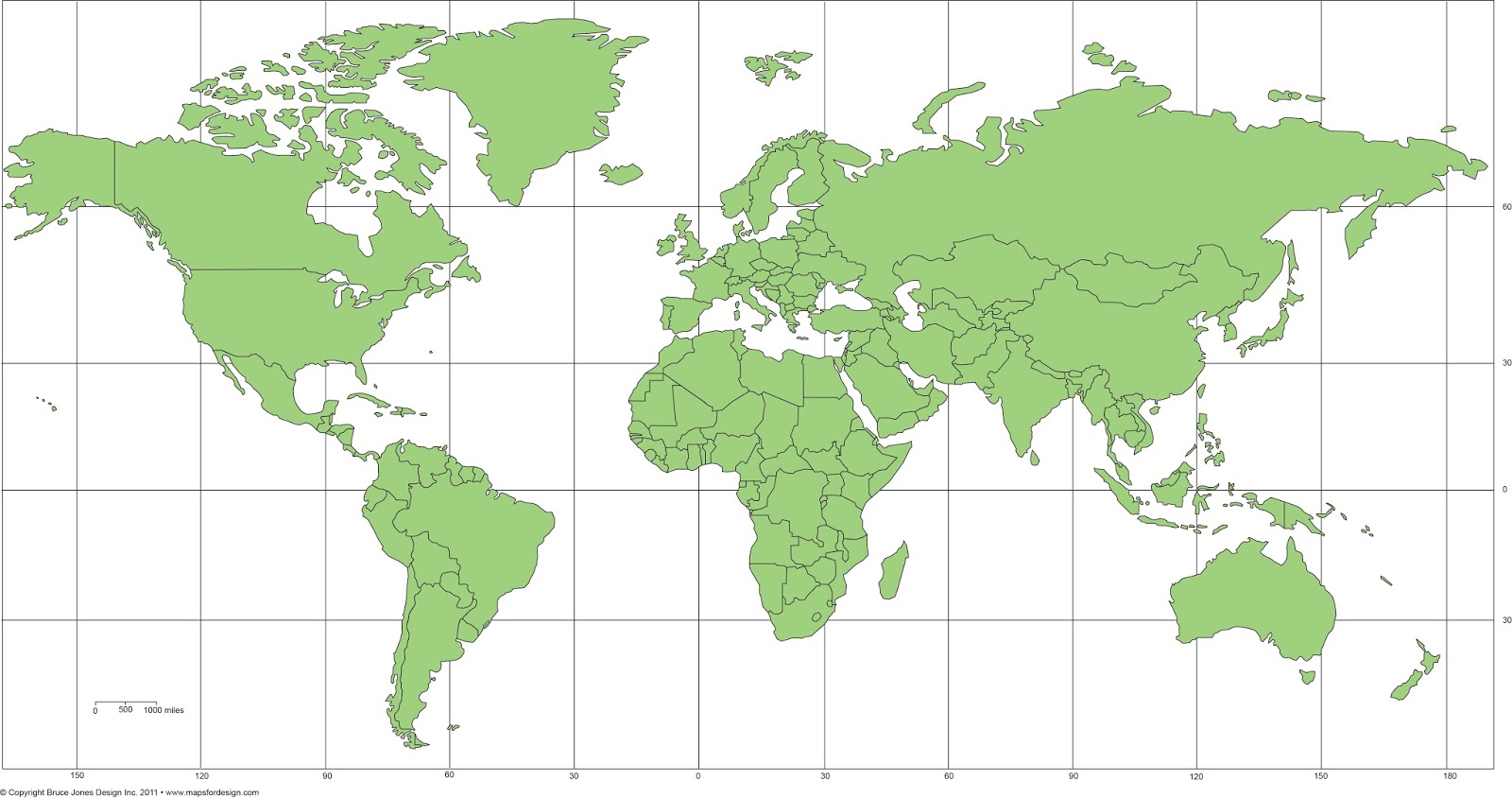
Let Me Show You How Easy the Maps are to Color and Edit in this new video on our editable PowerPoint World Projection Maps. Each country in the map is an
individual object that you can select and color. Select the Country with
your pointer, and fill with a new color.
All text is fully editable and can be added or changed. Use the insert text box in your tool bar and add new text.
It is easy to delete an element you don’t want or grab ones that you do to build a custom map.
Because
the maps are vector outlines the countries can be enlarged to reduced
with no loss of sharpness, just group the countries and change the size.
Right Click on your mouse or Control Click
You can add any of the PowerPoint objects or shapes such as a star, arrow or boxes to your map
Each map comes pre-loaded in a PowerPoint slide deck, you have a full map with land and text, just land, and just the text.
Maps can be shared with your team on multiple computers for no additional cost and are easy to email to anyone.
USA Editable PowerPoint Map with 2 Letter State Names Our Most Popular Map. It continues to be our base map year after year. The editable PowerPoint map has individual states with the two letter postal codes for names. Like all of our maps at MapsForDesign.com this file contains the combine land and text names slide, a slide with just the states themselves and a slide with just the names incase you happen to delete some names, you can just go grab them and put them back.
Like all of our maps they are royalty free, fully editable in PowerPoint and Apple Keynote and can be used for all kinds of presentations, including setting up a sales territory, website graphics and educations. The maps can be shared with your team and staff as needed.
USA editable PowerPoint map with 2 letter state names.
View of our large 28" x 20" USA National County Map with the included PowerPoint slides.
USA National PowerPoint Editable County Map
One of our most popular editable PowerPoint maps is our USA National County Map. Available on MapsforDesign.com site. This map is used by sales and marketing managers who want to set up a national county sales territory map with the big picture. This is a complicated map with over 3,000 counties, below are some tips for getting the most out of this map.
But we have a larger national county map that is 28" wide by 20" high. What we usually do is email this larger file to anyone who purchases the 17" x 11" map. Here is a link for the current PowerPoint USA National County map. I am going to work on getting the larger map up on MapsforDesign.com shortly.
Some key tips to keep in mind when you purchase and use this map for your projects.
• Grouping and UnGrouping - The county map is set up with each state's counties grouped together, and with their names set up as a group on top. Grouping and Ungrouping are very important when working with a map like this. I usually recommend that you customized one state at a time. You can pull a state out and paste it on a second slide, customize it and then put it back.
• Selecting Several Counties at The Same Time - Your Shift key is your friend for grabbing several objects at the same time and setting up a sales or marketing territory. Click on the first county, push down your Shift key and then click on additional counties. Once they are selected you can add a fill color to make them all the same.
• Selecting and Pulling Out Several States at The Same Time - The task is to select several states. It is usually easier with this map to delete what you don't want instead of trying to select what you do want. Once you have the surrounding states cleared out it is easy to grab the states you want.
• Snap to Grid - On all of our maps the Snap to Grid has been turned off. The default in PowerPoint is that the Snap to Grid is turned on. The Snap to Grid is an invisible grid in the PowerPoint slide that helps you line objects up. What happens with our maps is if Snap to Grid is on and you pull out several counties from the big map, customize them and put them back, it can be tough to get them back all lined up from where they came out from. If the grid is off it is easy. This comes into play if you select one of our maps and paste it into another presentation the Snap to Grid will be on. To turn it off hold down the Control key on your keyboard and Right Click with your Mouse. You will see it as an option in the pop up window, just click it off.
Map Monday video question about using our maps with your staff and downloading it to multiple PCs. No problem at, we love when multiple people use our maps for their projects and we make it as easy as we can for you to do this. Our maps are in PowerPoint format and they are easy to email around however you need.
If you have a lot of offices around the country or world we also have licenses for that, but for the general work team, feel free to share. For more info please contact us or visit www.bjdesign.com
We get asked this question fairly often on how to use our editable Powerpoint maps to make up blank map copy master for a school worksheet or presentation. It is real easy to do and this short video will take you through the steps
It is easy to make a blank, printable, outline Canada for marking up,
coloring, school project, whatever you need from our royalty free
downloadable PowerPoint clip art maps. Watch the video to learn how to
take a basic World of Maps map, select it and change the colors to have a
map with sharp, clean vector lines for your project. It is very easy to
produce a clean blank printable map.
1. After purchasing and
downloading our editable PowerPoint mapyou're your project, open it in
PowerPoint. For our example we are using a Canada map.
2. Select
the map with your pointer by clicking in the upper left corner of the
slide and dragging the pointer over the entire map so that it is
completely surrounded by the light blue field. Once you release you
finger all the land will be selected. You can also do this by choosing
Select All in the Edit pull down menu. You can also hold the SHIFT key
and select each province individually.
3. Once everything is
selected you can go to the Formatting Palette or up in the Ribbon --
Colors, Weights, and Fills and choose the Fill Bucket and fill the map
with the color white. I like using the white fill instead of nothing
because it is easier to select a province with color in it if you want
to customize it later. If you have no fill you have to grab the line to
select it, with a color fill you can click anywhere on the state to
select it. That is it, you are ready to go, save it and print it, pretty
easy.
TIPS: 4. If you group the map you can also resize it, (check out our enlarging and reducing video) and make a custom map.
5.
I usually recommend removing the text first but if you don't then just
hold down the shift key and select each state or county individually and
then fill with color.
Russia, China, India, and Southeast Asia editable PowerPoint Map.
On of our bigger more complex World Regional Maps. This map has the former Soviet Union, now independent countries, China, India and South East Asia. We have a number of maps of this region. This map comes in both PowerPoint and in Adobe Illustrator, all countries can be edited and customized however you need. It is also easy to change the colors to white and you have a blank, printable map for a worksheet or to color.
Today's post we look at our Central America map. Central America runs from just below Mexico down to Panama, including Guatemala, Belize, Honduras, El Salvador, Costa Rica, and Nicaragua. Often included in this map are the Caribbean Islands such as Cuba, Puerto Rico, Haiti, Jamaica, and many more. On the east is the Caribbean Sea and on the left the Pacific Ocean.
Central America with Belize, Costa Rica, El Salvador, Guatemala, Honduras, Nicaragua and Panama
Canada map with titles and individual Provinces and Territories for presentations from our World of Maps clip art collection of editable maps. This map is a fully editable PowerPoint or Adobe Illustration ready for building a presentation or customized for a classroom copy sheet. All text can be customized and the provinces can be colored.
Editable Canada Map with Provinces and Text from World of Maps Collection
One of our most popular editable editable country maps is Canada. We have them in several different ways, color, black/white, combined with the USA and standing alone. All of the elements on the map can be customized, land and text. Our Canada maps are available from both of our sites, www.bjdesign.com and www.mapsfordesign.com.
Color, editable map of Canada, with provinces, no text
Map of Canada, black/white outline map with text names, each province is an individual element.
We have been highlighting some of our World Regional Maps from our World of Maps collection. Today we show our editable Australia Oceania map. We actually have several maps of this area of the world, including individual country maps, Australia, New Zealand, Philippines Indonesia and more. All maps are editable and in both PowerPoint and Adobe Illustrator. This map is available at both of our sites, www.bjdesign.com and www.mapsfordesign.com
Australia and Oceania editable map, comes in both PowerPoint and Adobe Illustrator
Above is a copy of our Africa Map, one of the series of our World Regional Maps. This is an editable map, each country can be colored or changed, including taken out. All text is editable. We also have this map in Adobe Illustrator again with all countries individual objects. We have this map on both our World of Maps site, www.bjdesign.com and on www.MapsforDesign.com
We had a request from on of our World of Maps customers from www.bjdesign.com for a PowerPoint map of Ireland for a customer who was setting up sales territories. We have included that map in our Great Britain map all along but didn't have it as a separate map. Not sure why that happen, but sometimes things get over looked. The customer asked about an individual one, so easy enough to make up. I took the Great Britain map and deleted the UK parts and then enlarged the Ireland side, fixed the text a little and there you are. Our maps are pretty flexible and easy to change. Once done I sent the map off to the UK for the customer. We received back and very comment and I am glad to help.
Here is the comment, thank you very much, we love comments and we love finding out where we have holes in the collection. I will get this new map into the collection.
"Bruce, that's fantastic, thank you!
We use your maps every day when selling territories. Best maps we've ever bought!"
Paul
Republic of Ireland and Northern Ireland, editable PowerPoint Map
It is time for our Map Monday Video so on to a question that came into our comment box,
people send us all kinds of questions and we love to get them.
Today's
question comes a viewers boss and the question is do you have an
editable national US County PowerPoint map with all of the names listed
on the map.
Answer:
So they're asking about our USA National County
editable PowerPoint map. This is the map the entire national US County
editable PowerPoint map. This map is in PowerPoint and it has all the
counties in United States all 3120 of them and also has all of their
names on it.
So lets bring that map up here in PowerPoint so you
can see that. So this is a fully editable National US map of all the
counties in PowerPoint, all 3120 of them in United States. So if I click
on it let's say the state of Maine, lets zoom in here and I can select
this state and go to my formatting palette and choose another color. We
can change this orange color to say a yellow color. I still have the
entire state grouped so it all changes to one color, but everything in
this state is a separate editable County. The state of Maine is made up
of individual county maps and I can go and ungroup it in PowerPoint and
work each individual county. I go to the draw toolbar and I can just
click right here and I can now see all the individual counties are
separate objects. I can color each individual object and fill it with
its own color.
So that's what people are asking about, that can
they change these things, are they editable but what they are really
looking for is are there names on all of these counties. Because this is
a big map with a lot of names and a lot of counties and they wanted to
go in there and find their specific County and make the changes. So yes
we have a US national County map with all the usual counties and that we
also have a version with names on it. The name version isn't on the
site but we can send you that our version if you purchase of the regular
County map. It is a pretty big file so we just email it to you rather
than set up for download like all the others.
So not only can
you change all the individual counties and the colors but also the text
you just have to ungroup it is we have it group by state can keep it
organized. Each one of those names can be change, formatted differently,
deleted or moved around or whatever it is you want to do.
We
have lots of customers go in and customize this map especially when they
have a need for a general territory map that's crossing state lines.
There are much more sophisticated maps out there that are tied to a
database, we don't have that. Our map is all done by hand but it works
pretty well when you need to set up a basic territory map.
We also have individual state county maps in PowerPoint.
The
slide package also includes a version of the map with names, without
names, on a blank map with just names, and also a state outline map that
can be laid on top to give you a nice borders.
We had a great question from a customer on how to add new cities and location dots to our PowerPoint or Adobe Illustrator maps. This is pretty easy to do using either a text bullet or drawing a small circle and then a text box for the name. I also thought this would make a great video as we get this question now and then.
We love customer questions, please let us know what you need to know and we make up a video on the question.
We had a great question today on if we remembered the old pattern fill option in Powerpoint to fill an object. Great to show a state that is covered by two different people or topics. What we discovered is that is was taken out in PowerPoint 2007 but added back in for version 2010. I discovered an excellent tutorial on Indezine.com and how they have moved it from the Fill option to the Shape Fill Gallery. Here is the link to the tutorial.
Detail of our USA National editable county map with names in PowerPoint
USA National editable county map with names in PowerPoint
We got a good question today on our USA National County map, which was did we have a national US map with counties and their names and can it be edited in PowerPoint.
The answer is yes we do. We have several versions of this map, one with all the names and one without. Because of all the data, there are over 3,000 counties in the US, we set the map up on an 11x17 slide in PowerPoint. All the elements are editable, the type is live, each county can be colored or changed however you want. This map is great if you are setting a national territory map. We also have this same map in Adobe Illustrator format.
It is available for download from our www.mapsfordesign.com site in PowerPoint and also available from our subscription site www.bjdesign.com in illustrator and PowerPoint.
Do you have a PowerPoint presentation coming up where you need to show offices or territories, or locations on a map? Have you gone on line, pulled down a map on to discover that you can't edit it. You can't color in the states or counties or fix the text.
Well we have the solution, with our World of Maps editable PowerPoint and Adobe Illustrator maps you can build successful presentations, reports, design projects, websites. World of Maps is a collection of editable PowerPoint and Adobe Illustrator maps for building presentations, reports, graphic design, website and education. The maps are fully editable, with states, counties, countries, USA, World and continent regional maps.
Each map is fully editable, each country, county, state, is an individual object that can be colored, resized, moved around or even deleted. All text is live and can also be moved around. Perfect for making presentations, the maps come right in PowerPoint which almost everyone knows and is easy to email to your team.
We had an excellent question on printing out oversize maps from PowerPoint.
QUESTION: I would like to not only use your maps in my presentation, but also print them out on up to tabloid sized paper. Can I do that? Would it take a special software application? Or can I print right out of PowerPoint onto tabloid.
OUR ANSWER: The answer is yes. All of our maps are in vector format and can be enlarged or reduced to whatever size you want. The best way to do this is to make up a larger PowerPoint slide, say 11x17inches and then copy the map into the slide and then enlarge it. Check out Document Setup to make a larger slide.
The key thing to remember here is to set up the slide first then copy the map in and enlarge it. If you try to enlarge a standard size slide with a map in it, it will become distorted, so make the slide large first then paste the map in and then enlarge. You will also need a larger format printer or plotter to print the map out.
We also have a good instructional video on this topic.
If you have Adobe Illustrator then it is also very easy to enlarge, check out www.bjdesign.com for all of those maps