Showing posts with label blank map. Show all posts

Sunday, October 7, 2012

Canada and the Canadian Provinces Coloring Book

We are pleased to announce the release of our newest geography map coloring book. Canada and the Canadian provinces Coloring Book. In this book you will learn and color blank, outline maps of the Canada and its Provinces and Territories with Canada and the Canadian Provinces Map Coloring Book. The Canada Map Coloring Book includes blank, outline maps for learning Canadian geography, coloring, home school, education and even making up a map for marketing. Each blank, outline Province is presented with detail maps of political borders, capital, major cities and towns. 

Each Provinces or Territory is broken down to 6 maps with their names and other information like highways, rivers and lakes, cites and towns, and capital. Also included is a blank outline map without any information, which is great to color however you want. Along with each Province map is included their flag with some general information, including; Capital, Population, Size, Confederation, Motto, Bird, Flower, Tree, and a Fun Fact. Students can trace the outlines of the map, study and highlight regions and features. A great resource for students and kids.


Black outline, blank Canadian maps included in the coloring book are:
• Canada and the United States
• Canada
• Canada Provinces
• Canadian Flag
• Alberta
• British Columbia
• Manitoba
• New Brunswick
• Newfoundland and Labrador
• Northwest Territories
• Nova Scotia
• Nunavut
• Ontario
• Prince Edward Island
• Quebec
• Saskatchewan
• Yukon Territory
• North America
• North America Globe
• United States
• Each Province or Territory includes its flag.
Each map includes a blank version without names.

The printable, blank, outline maps in this coloring book can be freely photocopied by a teacher or parent for use in a classroom or for home school lessons.

Our book is available at Amazon.com in paperback. Click here to check Canada and the Canadian Provinces Coloring Book

Saturday, September 29, 2012

How to Make a Blank Canada Map in PowerPoint

We get asked this question fairly often on how to use our editable Powerpoint maps to make up blank map copy master for a school worksheet or presentation. It is real easy to do and this short video will take you through the steps


It is easy to make a blank, printable, outline Canada for marking up, coloring, school project, whatever you need from our royalty free downloadable PowerPoint clip art maps. Watch the video to learn how to take a basic World of Maps map, select it and change the colors to have a map with sharp, clean vector lines for your project. It is very easy to produce a clean blank printable map.

1. After purchasing and downloading our editable PowerPoint mapyou're your project, open it in PowerPoint. For our example we are using a Canada map.

2. Select the map with your pointer by clicking in the upper left corner of the slide and dragging the pointer over the entire map so that it is completely surrounded by the light blue field. Once you release you finger all the land will be selected. You can also do this by choosing Select All in the Edit pull down menu. You can also hold the SHIFT key and select each province individually.

3. Once everything is selected you can go to the Formatting Palette or up in the Ribbon -- Colors, Weights, and Fills and choose the Fill Bucket and fill the map with the color white. I like using the white fill instead of nothing because it is easier to select a province with color in it if you want to customize it later. If you have no fill you have to grab the line to select it, with a color fill you can click anywhere on the state to select it. That is it, you are ready to go, save it and print it, pretty easy.

TIPS:
4. If you group the map you can also resize it, (check out our enlarging and reducing video) and make a custom map.

5. I usually recommend removing the text first but if you don't then just hold down the shift key and select each state or county individually and then fill with color.

To see all of our How-To videos checkout the Instructional Video Page on our MapsforDesign.com site:  http://www.mapsfordesign.com/Instructional-Videos.html

Thursday, September 27, 2012

PowerPoint Russia, China, India and Southeast Asia Map

Russia, China, India, and Southeast Asia editable PowerPoint Map.
On of our bigger more complex World Regional Maps. This map has the former Soviet Union, now independent countries, China, India and South East Asia. We have a number of maps of this region. This map comes in both PowerPoint and in Adobe Illustrator, all countries can be edited and customized however you need. It is also easy to change the colors to white and you have a blank, printable map for a worksheet or to color.

Tuesday, May 4, 2010

World Projections Maps, Mercator, Robinson, Globes

Image directory of the editable world projection maps from our World of Maps collection, either downloaded or on CD-ROM. All of these maps are editable and come in PowerPoint and Adobe Illustrator. Collection includes Mercator, Robinson, Sinosouidal and Globe maps. Some have individual countries, and others are broken down by continents. All the elements can be edited, moved, colored, deleted, including the longitude and latitude lines. Because these are fully editable you can easily select the map, customize for your project, delete the color and you have a great blank, printable map. See all of the maps at www.bjdesign.com, samples are available that you can download.

Thursday, November 5, 2009

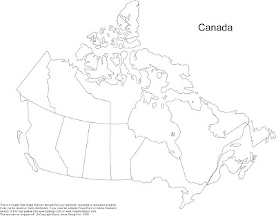
Blank Printable Canada Outline Map, no Text


Same as the map below but just without the text names. This blank, printable Canada map can be used for your personal, corporate or educational project. It is royalty free, it can't be resold or freely distributed but you can edit or copy it without any issues. This map prints out to 8.5 x 11. We have a full range of completely editable maps on our download clip art maps sites that you can check out if you need one that you can change however you need. www.bjdesign.com

We have also pull together a simple video on how to make up a blank map from one of our editable Powerpoint Maps, please see below