Downloadable Royalty Free, Editable, Digital, Perfect for Creating Sales Territory Maps
Thursday, November 5, 2009
5 More How to Instruction Videos for Customizing PPT Maps
6. Setting Up a Country Sales and Marketing Territory. Our editable PowerPoint county maps are very popular for highlighting a sales territory for people. We sell our maps to many sales and marketing managers and this is a very common request. Can I set up a simple territory map for my sales people. Our maps work great for this and this video walks you through the sets. View this video.
7. How to Divide a PowerPoint Clip Art Map In-half. This video covers one of our most asked questions. How to divide a state or county in half. Very ofter a state is covered by more than one sales rep and the manager needs to show this. PowerPoint isn't really a graphic program but we have come up with a number of techniques to do this.
8. How to Enlarge or Reduce an Object in PowerPoint. A common problem is that you have highlighted several states or counties for a presentation but they aren't big enough in the slide. This video shows you how to do this, bigger or smaller.
9. Printable, Blank, Outline USA and World Maps. We sell mostly PowerPoint and Illustrator maps with colors in them ready to go. But alot of people use blank maps that they can mark up and draw on. Our maps are great for doing this if you just remove the color. Plus most blank printable maps you find on the web can't be customized for your project. Ours, using PowerPoint which almost everyone has, can easily be. Remove the color and print it out. This video walks you through the steps, view it on YouTube.
10. This is a two part video, Favorite PowerPoint Customizing Tips, Parts 1 and 2. We have learned a lot over the years using our maps. In these two videos we release this info. We talk about Grouping and Ungrouping, using the Shift Key, and in Part 2 Enlarging and Reducing and the Snap to Grid feature.
Hope you enjoy them and find them useful. Let us know of any questions you have, maybe we will make it into a video.
Blank Printable Canada Outline Map, no Text
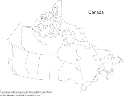
Same as the map below but just without the text names. This blank, printable Canada map can be used for your personal, corporate or educational project. It is royalty free, it can't be resold or freely distributed but you can edit or copy it without any issues. This map prints out to 8.5 x 11. We have a full range of completely editable maps on our download clip art maps sites that you can check out if you need one that you can change however you need. www.bjdesign.com
We have also pull together a simple video on how to make up a blank map from one of our editable Powerpoint Maps, please see below
Monday, November 2, 2009
Canada Printable Blank Map with Text Name
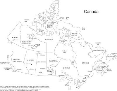 Blank, Printable map of Canada with text names and province borders. This jpg Canada map is royalty free and can be used for personal, corporate or educational projects. You can download it off this blog and edit and use it for your own projects. This map is part of our large collection of Free, Royalty Free US, World, States, Countries and Globes maps.
Sunday, November 1, 2009
Top How to Videos for Customizing PowerPoint Maps
1. Editable USA and Canada PowerPoint and Illustrator Royalty Free Clip Art Maps. Gives a good overview of our editable maps and how they work. This video can be viewed on YouTube
2. How Do I Color an Object in a PowerPoint Slide. Goes all how to easily select a state or country and color it to highlight a territory or location.
3. How to Add Text to a PowerPoint Slide. After adding color and setting up your territory, adding some text labels or sales peoples names is next. This video covers how to add text to the PowerPoint slide.
4. How Do I Set Up Hyperlinks on a PowerPoint Map? Setting up hyperlinks isn't something you do every day but is a real nice feature to have in your bag of trick to dress up a presentation. This video walks you through the steps.
5. How to Convert a PowerPoint Slide to a JPG File for a Website. PowerPoint has a lot of great features and one of them is to act like a temporary desktop publishing or photo program. Because our maps are so editable you can quickly set up a custom map graphic. I often end up recommending using PowerPoint as a quick work around to produce a graphic for some other purpose other than a presentation. Making a web graphic is one of those things. This video walks you through the very simple technique to turn a PowerPoint slide into a JPG file that can be used for a web graphic
Tuesday, October 27, 2009
How to Color a US State or Country Map in a PowerPoint Slide
 We have had great responses to our How to Videos that we post on bjdesign.com and mapsfordesign.com walking customers through the basic steps of customizing our USA, Canada or World Editable PowerPoint Maps. In this series of posts we are going to break down the Coloring a US State or Country PowerPoint Map video and show you the steps screen by screen. Remember our editable PowerPoint maps also work with Apple Keynote presentation software
You can also view this and all of our How to Customize our Editable PowerPoint Map Videos at www.mapsfordesign.com or www.bjdesign.com
Click to Read Part 1
Part 1. How to Color a US State PowerPoint Map to Set up a Sales Territory

Starting with anyone of our basic editable PowerPoint Maps, US, World, State County, Country, or World Regions, they all work the same.
Click or Select the state or country that you want to color by clicking on it with the mouse pointer. On the PC use the right button of the mouse, on the Mac just click with the mouse.
You can tell something is selected because you will see 8 little boxes or handles appear around the edges, this tells you the object has been selected and you can now do something to it. Make sure you have the Format Pallette or the Drawing Tools Window open.
You can view this video and all of our How to Customize our Editable PowerPoint Map Videos at www.mapsfordesign.com or www.bjdesign.com
Click to Read Part 2
Part 2. How to Color a US State PowerPoint Map to Set up a Sales or Marketing Map

Once you have a state or country selected, (remember you do this by clicking on the state with the mouse pointer) choose a color from the Fill Bucket in the Drawing Tool Bar usually located along the bottom of the PowerPoint slide or on one side.
Or choose a color from the Colors, Weights and Fills option in the Format Palette. If you don’t see it, this Palette it is located in the VIEW pull down menu.
On the new PowerPoint 2007 the fill options are located up at the top in the ribbon, Click on the Colors Button in the Design Tab in the Themes group. The Design Tab appears when an object is selected. Select your color
You can view this video and all of our How to Customize our Editable PowerPoint Map Videos at www.mapsfordesign.com or www.bjdesign.com
Click to read Part 3
Part 3. How to Color a US State PowerPoint Map to Set up a Sales Territory

You have now selected one state or country and filled it with a color. (remember you do this by clicking on the state with the mouse pointer and choosing a color from the Fill Bucket in the Drawing Tool Bar usually located along the bottom of the PowerPoint slide or on one side.
When done deselect by clicking off the image and start on your next state or country.
A couple of tips to help you manage your project:
1. Holding down the Shift Key on your keyboard allows you to select and change several objects at the same time to make the project go faster.
2. Every object in PowerPoint is made up of a fill color and an outline or stroke color, both can be changed independently of each other.
3. When you are done with a section you might Group it together to help you manage your project.
You can view this video and all of our How to Customize our Editable PowerPoint Map Videos at www.mapsfordesign.com or www.bjdesign.com
http://mapsfordesign.blogspot.com/2009/10/how-to-color-us-state-or-country-map-in.html
Wednesday, October 21, 2009
Blank Printable USA 2 Letter State Map
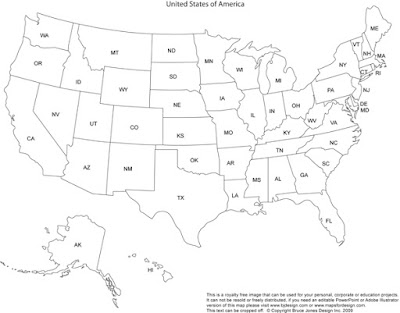
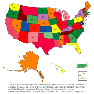
Blank Printable Outline Map of the US with 2 letter state names. Perfect for quickly sketching out some marketing data or a class assignment. This royalty free jpg map is located on our new www.freeusandworldmaps.com site. The home for all kinds of royalty free jpg maps. Including printable blank maps as well as all kind of colored US, World, States, Countries, and World Regions and Globes.
To learn more click here for www.freeUSandWorldMaps.com
Tuesday, October 13, 2009
Maps for Design.com Editable PowerPoint Maps
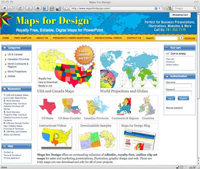
After a brief break we have relaunched our single downloadable editable Powerpoint clip art map site, MapsforDesign.com. The site carries a full line of editable PowerPoint maps for sales and marketing presentations, illustrations, web sites and classroom projects. Containing PPT maps of the World, US, States, Counties, World Regions, Countries and Globes. The site has a new look, is more efficient and will have an expanded collection of maps. Along with all the new features we have added the full line of our "How To Customize" videos to the site. Maps can be purchases individually for your projects. You can also purchase a CD if you wanted the entire collection.
If you need more than three PowerPoint maps we recommend you use our subscription site www.bjdesign.com where you can download as many maps as you want for one fixed price. Either way we have got you covered. BJDesign also carries the full line of Adobe Illustrator and jpg maps.
For an individual map, http://www.mapsfordesign.com
If you need lots of maps, http://www.bjdesign.com
Saturday, October 3, 2009
Strange Maps: An Atlas of Cartographic Curiosities
 Well now here is a interesting new book coming out later this month. Sounds like it might be a lot of fun, the book is based off of the Strange Maps blog by Frank Jacobs
Spanning many centuries, all continents, and the realms of outer space and the imagination, a collection of 138 unique graphics combining beautiful full-color illustrations with quirky statistics and smart social commentary. The result is a distinctive illustrated guide to the world. Categories of cartographic curiosities include: • Literary Creations, featuring a map of Thomas More's Utopia and the world of George Orwell's 1984
- Misconceptions, such as a lavish seventeenth century map depicting California as an island
- Political Parody, containing the "Jesusland map" and other humorous takes on voter profiles
- Whatchamacallit, including a map of the area codes for regions where the rapper Ludacris sings about having "hoes"
- Obscure Proposals, capturing Thomas Jefferson's vision for dividing the Northwest Territory into ten states with names such as Polypotamia and Assenisipia
- Fantastic Maps, with a depiction of what the globe might look like if the sea and land were inverted
Check it out at Strange Maps: An Atlas of Cartographic Curiosities
Also check out the Strange Maps blog
Friday, October 2, 2009
Focus on Europe Day, Scandinavia
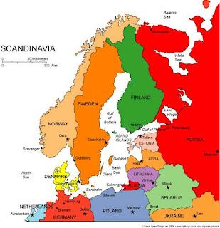 Well it is starting to get cold and fall is fast approaching, leaves will be turning soon. We were thinking of Europe and our attention drifted up to the Scandinavian countries, Norway, Sweden Finland and Denmark. We had produced this editable PowerPoint and illustrator maps a while back and thought it was time to bring it back out again.
Keep your attention to the blog, our MapsforDesign.com site is about to be relaunched, new shopping cart, easier to navigate, and a tighter focus on PowerPoint map for presentations. We have been working away on it for the past several months. In the mean time all of our maps are available at our subscription site, www.bjdesign.com for any of your projects. Remember we love questions so ask away.
Wednesday, September 16, 2009
Blank Printable World Mercator Map
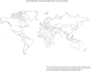
We have been working away on the new free map site, putting up all kinds of royalty free jpg maps, World, USA, States, Countries, Regions, Globes, and Antique Maps. One of the sections that we have is for free blank, printable world and also USA maps. Above is a free example of a World Mercator map. This can be download and used for your map projects. As always we have all our original editable PowerPoint and Illustrator maps over on www.bjdesign.com. To see the new jpg free maps click this link: www.freeusandworldmaps.com
Saturday, August 29, 2009
New Free JPG Map Website
We are please to announce the launch of a new website offering royalty free jpg maps for design, illustration, websites, and education. All of the maps are free to download and use for projects. The maps are perfect for printing or using in your projects. All maps are in jpg format and can easily be customized in any photo editing program.
The site includes World projections, US maps, US state and county maps, World regions, Globes, Countries. Plus soon to come will be Antique/Historical maps CD Roms and lots of resources.
To learn more click on over to www.freeusandworldmaps.com
Saturday, June 6, 2009
http://www.bjdesign.com, Join us on a tour of our World of Maps Clip Art Site our downloadable subscription map site. World of Maps at www.bjdesign is a collection of royalty free, Editable MS PowerPoint and Adobe Illustrator clipart maps for sales and marketing presentations, illustrations, graphic design, education and websites. This large collection of easy to download clip art contains editable maps of the World, USA, States, County, Countries, World Regions, and Globes.
With over 90 country maps, detailed US County maps, US State Maps, World Projections, Globes, and World Regions, you have one of the best collections for building your presentations. Remember in all of our editable PowerPoint and Illustrator state or country that each element is an individual object that can be customized, changed, colored however you like. The maps are easy to customize and change. We also include jpg copies of each map in color and black/white outline. Plus a very extensive FAQ section with how to tips and videos for customizing our maps, describing how to color, add text, enlarge or reduce, build territories and more.
Our editable royalty free clip art maps are perfect for sales and marketing presentations, showing sales territories, advertising, graphic design, building maps for websites, anywhere a royalty free map is needed
Saturday, May 23, 2009
Helpful How To Customize Clip Art Maps Video Tips
"Thanks, World of Maps for the video tips. I am in the process of adding names of cities to our maps and this is very helpful. I am pleased with the map program. Our salesmen have also appreciated the crispness of the finished product as opposed to the hand colored maps that were done in the past."
We now have all of our How To Edit and Customize video tips up online. You can check them out in our FAQ section http://www.bjdesign.com/html/questions.html
Thursday, May 21, 2009
Copyright and Using Clip Art Maps in a Book
I work for a Korean publishing company and would like to use one of your maps in our book. Does ordering the CD-Rom map for $199.95 clear all the copyrights problem? Is there a need to credit the map in usage? Also, can we use your map again later in other publications as well, or are we supposed to contact you for each usage? It'll be very helpful if you can let us know about these questions. Thank you!
bjdesign.com World of Maps Answer
Thank you for your visit and for your question. Our maps are used all the time in publications, book, magazine, etc. The maps are royalty free and you can use them in your publications today and tomorrow and into the future as much as you want. You do not need to give any credit and we do not need to be notified and there are no additional payments for usage. The maps are fully editable in Adobe Illustrator and PowerPoint, we also just completed latest upgrade, version 8.0 with 40+ new country maps and many other updates so there is a lot to choose from for your projects. Send us a link when you are done with your project, we would love to see the end result.
Tuesday, May 19, 2009
Setting Up A Clickable Map on a Web Site
I am building a web site that needs a USA map that once a state is clicked on counties show up, then I need to click on a county and have a page showing suppliers to show up. Do you have a map that will let me do this?
World of Maps Answer
Thank you for your question. The basic answer is yes. We have all of the map elements needed to build a drill down map. Starting with the top level USA maps and then each state or county to follow up. One of the ways to build this on your site is to make an image map with hot zones. This is usually done using your web authoring program. You would highlight with a tool the outer edge of each state and then assign it a link. The link then goes to a new page with the new information. You can see all of our maps at www.bjdesign.com
The other way people do this is with Flash, which is an animation program from Adobe. Our illustrator maps will work with Flash. There are also some good companies out there you could look at that have developed packages for this, you might want to check them out. http://www.flashmaps.com, http://www.flashimap.com/ and http://www.maps4.com/index.html.
I am not sure which way you are going. We have nice collection of illustrator maps that can be easily customized if you are going in the image map method, and if you know Flash then I would look at the companies above.
Sunday, May 10, 2009
Please Buy Maps on Our Subscription Site, www.bjdesign.com
Same great maps, two ways to buy.
Friday, May 1, 2009
Selecting Little Individule Countries in Our World Maps
Answer. The easiest way is to use the zoom feature of PowerPoint or Adobe Illustrator, 300% seems to work pretty well. Zoom in and select with the a click of your pointer. Once selected the country can be colored or changed
If you are using a map with names on it, it is often easiest to just move the name out of the way and then select the country with your pointer.
And a third way is to drag your pointer over or around the country. Holding down the mouse button and drag around the country your want to select. You will see dotted lines appear on the screen and this tells you that what is inside of them will be selected. In PowerPoint you have to go all around the object to select it, but if you just cross over border nothing will happen. In Illustrator an object will be selected if any part of the dragging mouse pointer goes over the edge.
For more information be sure to check out our How to Instructional Videos at MapsforDesign.com
New World Projection Map Add to the Collection
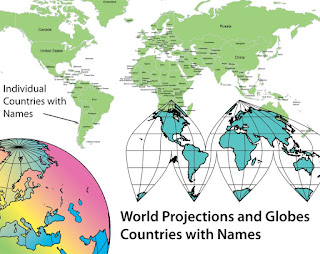
One of the new maps we have add in our recent World of Maps upgrade is a Mercator projection with individual countries and their names. This has been a very popular map with our PowerPoint users. Anyone doing a presentation where they have to show international offices or plotting data, this is the map. We also have a matching Adobe Illustrator version that has all the same features. The maps are completely editable and all elements can be changed, moved, put into new groups, text added and a question we are often asked, can they be deleted, the answer is yes.
Wednesday, April 29, 2009
Tips for Enlarging or Reducing a Group of Several States.
Our Answer: The basic key for enlarging or reducing several states is to use the grouping feature. Using your mouse pointer, hold down the shift key and select the states you want to enlarge or reduce. Holding down the shift key allows you to select several states at the same time, it also allows you to keep things proportional when you resize. Then select Group.
After grouping, you will see 8 handles around your object. With your pointer select one of the corner handles, hold down the mouse button and drag out or in, in a 45 degree direction to resize. After you have the size you want you can then ungroup. Text doesn't scale but it does move to the correct position. Before ungrouping resize the text using the general text size box located up in the top, then ungroup.
We have a series of videos that address this very topic. Please check this link. Customers have found them very helpful. Please feel free to contact us with any additional questions.
Thursday, April 23, 2009
World of Maps CD and Maps Can Be Used on More Than One Computer
Answer: You can use the CD on any computer, any time, any where, we put no limits on it. You can also share the maps within your work group in fact we encourage this. We ask that if you have needs in different offices, say in different cities, then we hope you buy a license but in your work group no problem. We want you to be able to do your job.
USA and Canada Editable PowerPoint and Illustrator Maps
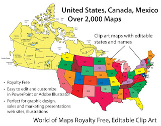 We offer a great collection of editable USA and Canadian maps. All maps are royalty free and fully editable in either PowerPoint or Adobe Illustrator, on our CD Rom or on www.bjdesign.com we also have jpg color and black and white versions of all the maps. All of the states, provinces and text are editable and can be changed, colored, moved around or even removed. Maps can be purchased on by subscription on www.bjdesign.com, or individually on www.mapsfordesign.com and at both you can pick up a CD-Rom.
Wednesday, April 22, 2009
Any Special Software Needed for Using the World of Maps Editable Clip Art Maps
Answer: They are just clip art maps in different formats. You just need to have MS PowerPoint for the PowerPoint maps, any version, or Adobe Illustrator for the Illustrator ones, and then any photo editing software like Adobe Photoshop for the jpg ones. Most people have at least one of these program and you can go from here.
Sunday, April 19, 2009
Top 10 PowerPoint Maps in a Special Promotion
We have a special promotion going on where you can purchase for one price the Top 10 PowerPoint maps that we sell. PLUS this package also includes a FREE copy of our entire World of Maps Collection CD-Rom with over 2,000 maps in PowerPoint, Adobe Illustrator and jpg formats. Yes this is our regular CD collection that we are offering with this special promotion. Also included on the disc is our new publication "How to Customize PowerPoint Clip Art Maps." The PowerPoint Top 10 map package you download right away so you can start working on your project, the CD will be mailed to you by US Priority Mail, shipping is free anywhere.
All map elements are royalty free and editable including the States, Countries and Text Names. This package includes our most popular maps. The special download PowerPoint package includes:
• USA with 2 Letter State Names
• USA with Full State Names
• USA and Canada
• USA Major Highways
• USA Major Cities, Capitals
• Canada
• Europe
• North America/USA/Canada/Mexico
• World Mercator with Countries & Names
• World Robinson with Countries
To learn more and see what is included click and jump over to our Special Top 10 PowerPoint Maps Promotion page on the MapsForDesign.com site.
Any further Maintenance for Using the World of Maps Editable Clip Art Maps
Answer: There is no maintenance on our product. They are just clip art maps in different formats. Pretty simple stuff.
Friday, April 17, 2009
How to Customize PowerPoint Map Videos Are Up
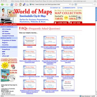
Our How to Customize PowerPoint Clip Art Maps videos are up for viewing on our World of Maps site at www.bjdesign.com. We have them loaded in our Frequently Asked Questions section. Videos include: How to Color, How to Add Text, Split a State in Half, Group and Ungroup, Build a Sales Territory, the entire set. To view you can go over to www.bjdesign.com and they are on the FAQ page or click this link.
Thursday, April 16, 2009
Is the CD version of World of Maps a Stand Alone Disc?
Answer: You do not have to go on line to use our CD, it is a stand alone product, it does not have any special security and can work on any PC. On www.bjdesign.com we offer a unlimited download subscription option for our maps and the CD is for backup of what you see on the site. On www.mapsfordesign.com, our site for picking up a single map, the CD is a backup of the online collection and is perfect if you have a need for more than 4 or so maps. The CD is a back up of everything, plus some additional material like the CIA World Fact Book Collection of maps and flags and our jpg collection of maps.
Wednesday, April 15, 2009
How Does the CD Version of the World of Maps Work?
Answer: Our CD is a backup of the entire collection. It has PowerPoint, Adobe Illustrator and JPG versions of every map. Along with our own maps is included the CIA World Fact Book maps collections and many other maps. A lot of our customers buy the CD when they are working on large projects that require a lot of maps or are traveling and need constant access, or just want a backup. The CD is available on both of our sites and now on Amazon.com
Monday, April 13, 2009
World of Maps Country Map, France
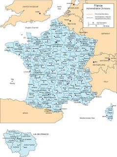
Map of France with all of the provinces and administrative districts, including captials of each. Available in both PowerPoint and Adobe Illustrator formats. This is one of over 90 world country maps in our collection of editable clip art maps. Check out our subscription site with unlimited download www.bjdesign.com to see more
Setting up Sales Territories with a Second Requirement
Answer: Thank you for visiting our site and for your question. I am not sure how you have your information and how much of it over laps each state. You do have the ability in PowerPoint to add more than one fill color to a state or country. This is usually done as a pattern and is located in the Fill Effects in the Fill pop up menu. You could have on color for each person and then two second colors, one for each exclusive and the other for nonexclusive. I would also set up a key on the side to help the viewer understand what is going on.
Adding Multiple Cities to a USA or World Map
Answer: Great question, one of the ideas we had when building our maps was to keep them pretty simple, to make them basic outline maps that are easy to customize for the wide variety of uses people have. Our maps aren’t set up with any database abilities but PowerPoint or Adobe Illustrator are powerful programs and you can add whatever you need.
The basic way to do would be to find a regular State or Country map that already has the cities you are looking for on it. The best place to find this is Google Maps or Google Images. Google Images is one of the navigation button on the main Google screen, you can search on the map in question. Hundreds will come up. I look for a map that is 50K or more in size and save it to my computer.
This map is then brought into PowerPoint or Illustrator using the Insert or Place commands and is sized and turned to approximately fit the outline of your existing state. You are basically use the image from Google as a template to locate your cities. You can use the shapes or drawing tools to draw small city dots and you can place them over the cities on the map graphic. Add city names, when finished delete the state or country graphic. Once you get the hang of it the process moves pretty quickly.
Don't forget, blog readers get a special 20% discount on our Maps for Design editable PowerPoint and Illustrator maps, any number of maps, any item, including the CDs, simply enter the coupon code: "MapBlog" during checkout to receive. Discount good till 12/31/2009.
Friday, April 10, 2009
How to Split a State or Country in Half
Answer: Yes you can split a state in half. If you are using our Adobe Illustrator clip art it is pretty straight forward. You use the scissor tool and cut the lines, you then use the line tool and rejoin the parts and fill them.
If you are using PowerPoint it isn’t possible to cut the state border lines, but we have figured out two work arounds for this. We have set up a web site with How to Videos where this is explained, also if you sign up for our Tips lessons you can download the How to Book.
If you go to this site : http://mapsfordesignhowto.blogspot.com/
To put it simply you can split the state but you can make it look like you did by overlaying a piece of the state on top of the existing state and coloring it. With simple outline states like Colorado you can just trace the border with the drawing tool. With more complex state outlines like California you copy the state and then nibble away the points with the edit points tool. Add a new color, lay it on top and to the viewer it looks like the state has been split in half.
Sunday, April 5, 2009
Our Maps are Great for Making Blank, Printable, Outline Maps
We get this question from customers all the time,
so we pulled together a short video on the topic:
Can your maps be used for making a blank, printable, outline map
and will the lines be sharp and clear?
Watch the video above to see the demonstration.
Our maps work great for producing blank outline maps. Our editable
maps print out of either PowerPoint or Adobe Illustrator with nice
sharp clean lines because all of the objects are produced with
vector lines. No bitmap lines here. The maps are easy to make,
just select the entire map and fill with white. I usually recommend
adding white because you can then select an individual state if you
want without trying to grab the line.
So change the fill to white, adjust your line weight if you want,
enlarge or reduce to the correct size and print.
Depending on your printer you can also scale to any size.
Whether you are using our Editable PowerPoint maps or our Adobe
Illustrator clip art maps, it is easy to produce a clean blank
printable outline map.
Sunday, March 29, 2009
World of Maps New Clip Art Map Release
World of Maps is please to release Version 8.0 or our Editable MS PowerPoint and EPS clipart maps for sales and marketing presentations, illustrations, and websites. Royalty Free, World, USA, States, County, Countries, World Regions, and Globes.
With over 90 country maps, 40 of them brand new, an updated World projection map with names and many other upgrades this is the best collection yet of our World of Maps Clip Art Collection. Each state or country is an individual element that can be customized, changed, colored however you like.
This royalty free clip art collection is perfect for sales and marketing presentations, showing sales territories, advertising, graphic design, building maps for websites.
Sunday, March 22, 2009
How Do I Plot a Lot of Data on a Map?
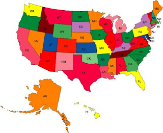
Hi all, this is a question I get pretty regularly. The questions goes like, I have a database of information, maybe some sales or marketing data, and I want to plot it on a map. Can I do this with your maps?
The answer is yes of course. But then the question goes deeper with, I have a lot of data, then the answer goes to maybe. Our maps are great for setting up basic sales territories, or plotting where your offices are located, where your customers come from, etc. They are easy to use, and color and add info. You can easily pull out states or countries to highlight a region. Use the stock shapes that come with PowerPoint to add locations. Our customers love our maps for their nice simple ease of use.
But if you have a lot of material then doing this kind of thing by hand becomes a real drag. That is when you need to move up to the bigger programs. Programs like Territorymapper or real big applications like Mapinfo. These programs allow you to take your database or excel spread sheet and plot it automatically over a map. Saving you tons of time and also allowing you to update and do analysis as you need.
Many of our customers use both our maps and the bigger programs. They need to do something quick or maybe the overview USA slide or World slide, they turn to our maps. And then to show the drill down of detail, the nitty gritty stuff, they go to one of these big guys. We love customers to buy our maps for their projects, but sometime it is just better to use a product that is more designed for massive amounts of information.
Here are some of the more popular programs on the market.
http://www.territorymapper.com/
A Windows based desktop application to help design territories. This is the one we recommend the most. It is affordable and it seems to show up more than others with positive reviews.
http://www.tactician.com/
A business mapping software for site selection, sales territory alignment planning and Market analysis
http://www.maponics.com
Maponics specializes in custom mapping services and GIS data for businesses.
MS MapPoint, http://www.microsoft.com
Gives you the power to visualize business data, communicate insights with instant impact, and integrate maps into the work you do in Microsoft Office.
http://www.mapinfo.com/
A very powerful desktop mapping application for sales and marketing data. This is one of the big guys in this area
We love you to use our maps, but sometimes they just don't fit and in that case there are lots of options.
Don't forget, blog readers get a special 20% discount on our Maps for Design editable PowerPoint and Illustrator maps, any number, any item, including the CDs, simply enter the coupon code: "MapBlog" during checkout to receive. Discount good till 12/31/2009.
Wednesday, March 18, 2009
New World of Maps Countries
Hi all, the new country maps are shipping out all over the world, by download and CD Rom. Version 8.0 of the World of Maps Clip Art collection now contains over 90 editable PowerPoint, and Illustrator countries. All fully editable with all countries, states, text name etc, able to be changed, colored, moved and deleted. This is our biggest release yet of maps and we are very exited about it.
Monday, February 16, 2009
World of Maps Royalty Free for Publications
maps in a publication. "We would like to use your maps in a upcoming
book, does ordering the CD-Rom of maps clear all the copyrights issues?
Is there a need to credit the maps in usage? Also, can we use your maps
again later in another publication and do we need to contact you or
give credit each time?
Great questions. The maps are royalty free and you can use them in your
publications today and tomorrow and into the future. You do not need to
give any credit and we do not need to be notified and there are no
additional payments for usage. The maps are fully editable in Adobe
Illustrator and PowerPoint so you can customize them however you need
for your publications. We also just completed our version 8.0 with 40+
new country maps and many other updates, so you are just in time to
receive that. We are working on getting all of the maps up on the
website and will shortly but the CD is shipping now and it contains
everything. So thank you and please let me know if you have any
additional questions and thank you contacting us.
bruce jones
Saturday, February 7, 2009
New World of Maps Clip Art CD is in House
HI all, quick update. Our new World of Maps Clip Art Collection CD is in house and is now shipping. We haven't gotten all the web sites updated yet but any CD orders will now ship with the new CD. Yeah! More news coming
We have add lots of new country maps to the collection bringing it up to a total of 94. We have also added our new Mercator World Projection map with countries and their names to the disc. Lots of other general fixes and updates. All maps come in editable PowerPoint and Adobe Illustrator format and in color and black/white jpg.
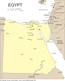
Here is a list of the new countries: Afghanistan*, Antilles and Aruba, Austria, Azerbaijan, Bahamas, Bahrain*, Bermuda, Bolivia*, Bosnia and Herzegovina, Bulgaria, Caribbean Eastern Islands, Caribbean Islands, Cayman Islands, Chile*, Columbia*, Croatia, Cyprus, Ecuador, Egypt*, Estonia, Georgia (Country), Hungary, Iran*, Iraq*, Jamaica, Jordan*, Kazakhstan, Kosovo, Kuwait*, Kyrgyzstan, Laos*, Latvia, Lebanon*, Lithuania, Macedonia, Malaysia*, Malta, Montenegro, Nigeria, Oman*, Pakistan*, Paraguay*, Peru, Philippines, Puerto Rico, Qatar*, Romania, Russia, Saudi Arabia, Serbia and Kosovo, Singapore*, Slovakia, Slovenia, Syria*, Trinidad and Tobago, Turks-Caicos, Ukraine *, Uruguay*, Uzbekistan*, West Bank and Gaza*
*Country Outlines Only
Wednesday, February 4, 2009
New Maps to Release Soon
The updates to the website are also moving along. So watch your email if you have signed up on our list for the latest news or check out this blog.
Clip Art Maps are Easy to Download
It is pretty easy, after you have filled out the order form with the credit card and stuff you will be taken to the main download page. All of the maps are located there. With bjdesign.com you can come back to that page as much as you want, and download what ever you need over the course of a year. The maps you download are yours to keep forever. To download you click and hold on the word DOWNLOAD that is in-front of each map name, and then save it to your hard drive. The maps open from your hard drive in either PowerPoint or Illustrator or maybe a photo editing program, depending on what you downloaded. There are also instruction on ever page. The most popular maps are located on the main download page and the rest are located from from the navigation on the left.
Our other single download site, www.mapsfordesign.com, does it a little different. There is a Download link right under the map name on the invoice form that you get after you place your order and also in the email that comes right after the order.
Any questions please let me know and I will try to help, thanks to all.
Wednesday, January 28, 2009
Splitting a PowerPoint Map into Two Pieces
We take you through the step by step process. Any questions please let us know. Also this lesson is outlined in our new How To Customize PowerPoint Maps book.
Monday, January 19, 2009
New PDF Book on Customizing PPT Clip Art Maps
Hi all, we are please to announce the release of a free pdf book on customizing and editing our PowerPoint clip art maps. We have loaded the pdf up on www.scribd.com a cool site for hosting pdf files. Please checkout the book and download a free copy for yourself. As always we welcome all comments and suggestions.
Click on this link to download. "How to Customize PowerPoint Clip Art Maps"