Showing posts with label World Map News. Show all posts

Saturday, September 30, 2017

PDF World of Maps 5 Books Combo Package

PDF Map Pack of 5 Coloring Books, World, USA, Canada, World Globes, USA States from Bruce Jones on Vimeo.


Get All 5 PDF Map Books for the price of one! In this one Combo collection we include all 4 of our PDF Blank Outline Map Coloring Books. The collection includes: World Maps with Globes and Projections, USA and States, World Regional Maps and Canada, Provinces, Territories and Flags maps.   

Each blank, outline, printable continent map is presented with a detail version with political borders, country, capitals, major city names and country name, and then an outline map with just country names and a blank outline map without any of the information, great to color however you want. The books are great for learning world geography, coloring, home school, classroom and general education. 

The printable, blank, outline maps in this books can be freely photocopied by a teacher or parent for use in a classroom or for home school lessons.


BOOK 1 World Regional Maps PDF Coloring Book: Blank Maps, Continents, World Projections, USA and Canada
Black outline blank world maps included in the coloring book are:

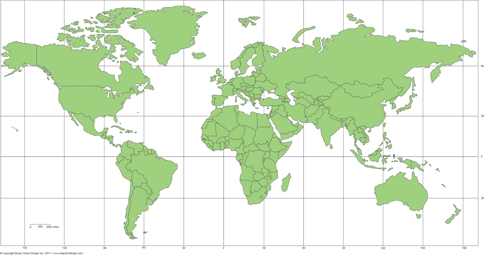
World Maps – Robinson Projection, World Maps – Mercator Projection
• United States Outline Maps, with and without names, Canada Maps, with and without names

World Regional and Continent Maps:
• Africa Map, Asia Map, Australia, Oceania Map, Australia Map, Europe Map, Maps of North America including Canada, USA and Mexico, South America, Antarctica Map

Additional world regions maps included are:
• Russia Map, Central America and the Caribbean Map, Central America Map, Europe to the Ural Mountains Map, Eastern Europe Map, Eastern Europe – Baltic Region Map, Middle East Map, Mediterranean Regional Map, Latin America Map, Scandinavia Map, Southeast Asia Map


BOOK 2 USA Maps and the 50 USA States Coloring PDF Book
USA Maps and the 50 States PDF Coloring Book contains each of the 50 US states, Arizona to Wyoming.  Each outline map is presented in two ways, one page has the map with corresponding cities, capitals and physical features and the next page has the blank outline without any of the information, state facts and then each state placed in context with its surrounding states. Students can trace the outlines of the map, study and highlight cities, capitals and features, and finally review by filling in the pertinent data on the blank map.  Each state is located on a USA map and is a great resource for students.

Also included are US territories: Guam, Saipan, Northern Mariana Islands, Puerto Rico, and the United States Virgin Islands.


BOOK 3 USA State Maps Coloring Book, Includes USA, Canada and North America Blank Maps PDF Book
Same basic maps as the USA Maps and the 50 USA States book above but designed for younger students. The maps are a little simpler and with less detail. 


BOOK 4 Canada, Provinces and Territories Map PDF Coloring PDF Book
The Canada, Provinces and Territories PDF Map Coloring Book includes blank, outline and labeled maps of each Province or Territory. the detailed maps include political borders, capital, major cities and towns. Includes a variety of maps with names and other information like highways, rivers and lakes, cites and towns, and capital.

Along with each Province map is included their flag with some general information, including; Capital, Population, Size, Confederation, Motto, Bird, Flower, Tree, and a Fun Fact. 

Black outline, blank Canadian maps included in the coloring book are:

Canada and the United States, Canada, Canada Provinces and Territories: Alberta, British Columbia, Manitoba, New Brunswick, Newfoundland and Labrador, Northwest Territories, Nova Scotia, Nunavut, Ontario, Prince Edward Island, Quebec, Saskatchewan, Yukon Territory, North America, North America Globe, United States. Each Province or Territory flag is also included.


BOOK 5 World Maps and Globes PDF Coloring Book
Learn and color the basic geographic layout of the world with World Maps and Globes PDF Coloring Book. World Maps and Globes PDF Coloring Book is great for coloring, home school, learning about the world. The maps are blank, outline, un-labled maps, presented in several ways, one page with detail and the other page with a blank outline without any of the information, great to color however you want. 

Black outline blank World maps included in the book are:

World Robinson Projection Map
• World Mercator Projections Map, Sinusoidal 6 point World Projection Map, United States Map with and without state names, Canada and North America Map

Also lots of Globe maps to color: North & South America Globe Map
• Europe Globe Map, North America Globe Map, South India Ocean Globe Map, South America Globe Map, Pacific Ocean Globe Map, Middle East Globe Map, Japan & Pacific Ocean Globe Map, India & Asia Globe Map, Australia Globe Map, Africa Globe Map, North Pole Globe Map, South Pole Globe Map

The printable, blank, outline maps in this books can be freely photocopied by a teacher or parent for use in a classroom or for home school lessons. Download the Pack Today


Buy the Map Book Pack

Monday, June 5, 2017

How to Color a World Projection PowerPoint Map to Make a Sales Presentation Map


Let Me Show You How Easy the Maps are to Color and Edit in this new video on our editable PowerPoint World Projection Maps. Each country in the map is an individual object that you can select and color. Select the Country with your pointer, and fill with a new color.

All text is fully editable and can be added or changed. Use the insert text box in your tool bar and add new text.

It is easy to delete an element you don’t want or grab ones that you do to build a custom map.

Because the maps are vector outlines the countries can be enlarged to reduced with no loss of sharpness, just group the countries and change the size. Right Click on your mouse or Control Click

You can add any of the PowerPoint objects or shapes such as a star, arrow or boxes to your map

Each map comes pre-loaded in a PowerPoint slide deck, you have a full map with land and text, just land, and just the text.

Maps can be shared with your team on multiple computers for no additional cost and are easy to email to anyone.

To learn more about our editable world projection PowerPoint maps please click this link:
https://www.mapsfordesign.com/product-category/world-projection-maps/ 


World Mercator Map, in PowerPoint, fully editable, ready to be customized for your presentation. Comes with and with out names.

Click here to see our World Mercator Projection PowerPoint Map with Individual Editable Countries and Names

Friday, October 15, 2010

Easy of Working with Our Editable PowerPoint Maps

We had a nice comment today from a customer that need to do a lot of customizing on one of our maps. They also need to duplicate the map for a book as well as the web. They bought one of our PowerPoint maps and then we sent along the matching Illustrator map for their designer. We got this comment back.

Bruce,

I am having fun working with the map I just ordered!  You have done a very
good job designing it and making it easy to use.

Thank you for the attached file, I'll forward it to my illustrator.

Have a great weekend!

Rich

Monday, September 6, 2010

12 New How-to Videos for MapsforDesign Editable PowerPoint Maps


We have been quiet but quite busy lately here at the World of Maps. We have been redoing all of our How-To Videos for editing and customizing our editable PowerPoint Maps for MapsForDesign.com. Reworking each one to clean it up, update for PowerPoint 2007, and give everyone better instructions one how to do the different tasks. It has taken a while but we are done and they are now up on YouTube and will shortly be up on the MapsforDesign.com instruction page.

Some of the thing we did were simplified each video-"One Video/One Idea, aka Ed Dale," rewrote the YouTube and website text, new graphics, consistent look across all videos, beefed up the keyword research for better tags and helping customers find what they need, improved the titles and really worked enhancing the YouTube page. The goal was to have it all done for Labor day so that we can turn the videos over to our web master and he can connect them all to the site. Over the next couple weeks we will post each one here also.

You can visit the YouTube channel at http://www.youtube.com/user/editablemaps and see all the new videos

Let us know what you think and are some more videos we should be pulling together.

Tuesday, May 4, 2010

She Does a Better Job Than Map Quest! - Slate Article

"She Does a Better Job Than Map Quest!"Wonderful hand-drawn maps from firefighters, club-hoppers, Boy Scout dads, grandmothers, and Alexander Calder.

Julia Turner


"Last month, I asked Slate readers to send me their hand-drawn maps. The request was part of my series on signs, the tools that professionals use to orient us and direct us from point A to point B. But official signs aren't the only things that help us get around. Since early man first drew on his cave wall—including marks that some scholars argue were maps of local rivers and settlements—we've been sketching out routes to guide one another to the market and to the mountain top. "
Read more of this cool article sent to us by one of our readers at the on line magazine Slate . . .

Earthquake Lists and Maps from the USGS

There is a cool page on the USGS website from their Earthquake Hazards Program, it is a list of Earthquake Lists and Maps. The page lists vast amounts of information for the US and the World on Earthquakes. Including: Deadly Earthquakes, Density Maps, General Information, Statistics, the Largest Earthquakes, Historic Earthquakes going back to 856AD.

Here is a fun little earthquake fact. From 1975 - 1995 there were only four states that did not have any earthquakes, florida, Iowa, North Dakota and Wisconsin.

Also included are the Last Earthquakes in each state and country, Seismicity Maps and the really big significant earthquakes. This is as great page for getting all kinds of information on earthquakes. You can also check out all kinds of other info on earthquakes at the USGS Earthquake sites.
Earthquakes (reillustrated) (Let's-Read-and-Find-Out Science 2)

Friday, May 1, 2009

New World Projection Map Add to the Collection


One of the new maps we have add in our recent World of Maps upgrade is a Mercator projection with individual countries and their names. This has been a very popular map with our PowerPoint users. Anyone doing a presentation where they have to show international offices or plotting data, this is the map. We also have a matching Adobe Illustrator version that has all the same features. The maps are completely editable and all elements can be changed, moved, put into new groups, text added and a question we are often asked, can they be deleted, the answer is yes.

Saturday, February 7, 2009

New World of Maps Clip Art CD is in House


HI all, quick update. Our new World of Maps Clip Art Collection CD is in house and is now shipping. We haven't gotten all the web sites updated yet but any CD orders will now ship with the new CD. Yeah! More news coming

We have add lots of new country maps to the collection bringing it up to a total of 94. We have also added our new Mercator World Projection map with countries and their names to the disc. Lots of other general fixes and updates. All maps come in editable PowerPoint and Adobe Illustrator format and in color and black/white jpg.

Here is a list of the new countries: Afghanistan*, Antilles and Aruba, Austria, Azerbaijan, Bahamas, Bahrain*, Bermuda, Bolivia*, Bosnia and Herzegovina, Bulgaria, Caribbean Eastern Islands, Caribbean Islands, Cayman Islands, Chile*, Columbia*, Croatia, Cyprus, Ecuador, Egypt*, Estonia, Georgia (Country), Hungary, Iran*, Iraq*, Jamaica, Jordan*, Kazakhstan, Kosovo, Kuwait*, Kyrgyzstan, Laos*, Latvia, Lebanon*, Lithuania, Macedonia, Malaysia*, Malta, Montenegro, Nigeria, Oman*, Pakistan*, Paraguay*, Peru, Philippines, Puerto Rico, Qatar*, Romania, Russia, Saudi Arabia, Serbia and Kosovo, Singapore*, Slovakia, Slovenia, Syria*, Trinidad and Tobago, Turks-Caicos, Ukraine *, Uruguay*, Uzbekistan*, West Bank and Gaza*

*Country Outlines Only

Monday, December 24, 2007

Nigeria Map Added to the Collection


We just finished drawing Nigera and have added it to our collection. Nigeria is located on the western side of Africa and gets us started working on a new continent.

Tuesday, December 4, 2007

Keep Up to Date with New Russia PowerPoint and EPS Map


We have completed several new maps recently which we are excited about. One of our newest is a map of Russia. We have been wanting to do this map for a long time but had just to many other projects going on. Now complete, the new map is available in PowerPoint and EPS for Adobe Illustrator. Both maps contain the Russian administrative districts and are completely editable with all elements objects and all type live.
The PowerPoint maps contains both just a map of the country and a map with the surrounding countries. This is great for setting up your next presentation.

Friday, September 28, 2007

Burma in Southeast Asia

A Crisis in Myanmar/Burma


The world is watching what is going on in YANGON, Myanmar/Burma. Above are some maps from the CIA on the region. These maps are also included in our www.mapsfordesign.com World of Maps PLUS CD-ROM disc that is available in the map store on the site.

They are also available for download at the University of Texas Perry-Castaneda Library Map Collection. A great place for reference maps.