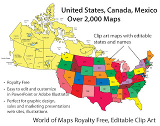
 We offer a great collection of editable USA and Canadian maps. All maps are royalty free and fully editable in either PowerPoint or Adobe Illustrator, on our CD Rom or on www.bjdesign.com we also have jpg color and black and white versions of all the maps. All of the states, provinces and text are editable and can be changed, colored, moved around or even removed. Maps can be purchased on by subscription on www.bjdesign.com, or individually on www.mapsfordesign.com and at both you can pick up a CD-Rom.
Downloadable Royalty Free, Editable, Digital, Perfect for Creating Sales Territory Maps
Thursday, April 23, 2009
USA and Canada Editable PowerPoint and Illustrator Maps
 We offer a great collection of editable USA and Canadian maps. All maps are royalty free and fully editable in either PowerPoint or Adobe Illustrator, on our CD Rom or on www.bjdesign.com we also have jpg color and black and white versions of all the maps. All of the states, provinces and text are editable and can be changed, colored, moved around or even removed. Maps can be purchased on by subscription on www.bjdesign.com, or individually on www.mapsfordesign.com and at both you can pick up a CD-Rom.
Subscribe to:
Post Comments (Atom)
No comments:
Post a Comment