Downloadable Royalty Free, Editable, Digital, Perfect for Creating Sales Territory Maps
Sunday, March 29, 2009
World of Maps New Clip Art Map Release
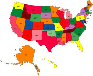
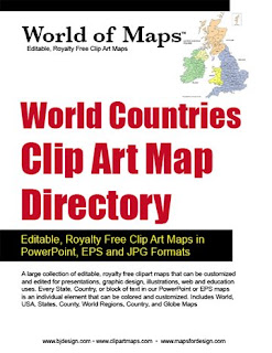
World of Maps is please to release Version 8.0 or our Editable MS PowerPoint and EPS clipart maps for sales and marketing presentations, illustrations, and websites. Royalty Free, World, USA, States, County, Countries, World Regions, and Globes.
With over 90 country maps, 40 of them brand new, an updated World projection map with names and many other upgrades this is the best collection yet of our World of Maps Clip Art Collection. Each state or country is an individual element that can be customized, changed, colored however you like.
This royalty free clip art collection is perfect for sales and marketing presentations, showing sales territories, advertising, graphic design, building maps for websites.
Sunday, March 22, 2009
How Do I Plot a Lot of Data on a Map?

Hi all, this is a question I get pretty regularly. The questions goes like, I have a database of information, maybe some sales or marketing data, and I want to plot it on a map. Can I do this with your maps?
The answer is yes of course. But then the question goes deeper with, I have a lot of data, then the answer goes to maybe. Our maps are great for setting up basic sales territories, or plotting where your offices are located, where your customers come from, etc. They are easy to use, and color and add info. You can easily pull out states or countries to highlight a region. Use the stock shapes that come with PowerPoint to add locations. Our customers love our maps for their nice simple ease of use.
But if you have a lot of material then doing this kind of thing by hand becomes a real drag. That is when you need to move up to the bigger programs. Programs like Territorymapper or real big applications like Mapinfo. These programs allow you to take your database or excel spread sheet and plot it automatically over a map. Saving you tons of time and also allowing you to update and do analysis as you need.
Many of our customers use both our maps and the bigger programs. They need to do something quick or maybe the overview USA slide or World slide, they turn to our maps. And then to show the drill down of detail, the nitty gritty stuff, they go to one of these big guys. We love customers to buy our maps for their projects, but sometime it is just better to use a product that is more designed for massive amounts of information.
Here are some of the more popular programs on the market.
http://www.territorymapper.com/
A Windows based desktop application to help design territories. This is the one we recommend the most. It is affordable and it seems to show up more than others with positive reviews.
http://www.tactician.com/
A business mapping software for site selection, sales territory alignment planning and Market analysis
http://www.maponics.com
Maponics specializes in custom mapping services and GIS data for businesses.
MS MapPoint, http://www.microsoft.com
Gives you the power to visualize business data, communicate insights with instant impact, and integrate maps into the work you do in Microsoft Office.
http://www.mapinfo.com/
A very powerful desktop mapping application for sales and marketing data. This is one of the big guys in this area
We love you to use our maps, but sometimes they just don't fit and in that case there are lots of options.
Don't forget, blog readers get a special 20% discount on our Maps for Design editable PowerPoint and Illustrator maps, any number, any item, including the CDs, simply enter the coupon code: "MapBlog" during checkout to receive. Discount good till 12/31/2009.
Wednesday, March 18, 2009
New World of Maps Countries

Hi all, the new country maps are shipping out all over the world, by download and CD Rom. Version 8.0 of the World of Maps Clip Art collection now contains over 90 editable PowerPoint, and Illustrator countries. All fully editable with all countries, states, text name etc, able to be changed, colored, moved and deleted. This is our biggest release yet of maps and we are very exited about it.
Subscribe to:
Posts (Atom)