Tuesday, December 27, 2011

How Do I Download My Map?


We received a call today for a customer on our www.MapsForDesign.com site. He was buying a map PowerPoint Georgia County Map and couldn't quite figure out how to download the map and had a couple of questions on customizing it. The download link is just below the name of the map on the invoice form, but sometimes it doesn't seem to stand out and people give a call. We helped him and actually to get it there quickly I just emailed the map back to him. I received a nice email back from the customer and wanted to share it, I asked and he gave permission.

Bruce,

Very nice experience,

I was able to color code the counties, dropped the major cities andhighways right on top, Just what I wanted to do. Really appreciated you sending me the ppt. When I called, I was hoping I would get the kind of service you provided but I was also doubtful it would happen. Thank you!

Dick

I replied back,


Hi Dick, thank you very much for the follow up and the comments, I work hard at the customer service side and at making our maps useful.

thank you very much

bruce

And one final message

Sure - deserve it. I have not had a real positive experience with purchasing these kinds of services over the net. You did everything advertised and provided personal service back up. Thanks again.

Dick

We love getting calls from our customers, and we love answering questions.


Monday, December 19, 2011

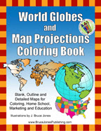
New World Globes and Map Projections Coloring Book

We have been pretty busy at map central working on some new projects. Some of them are in a new direction producing actual paper books for educations, learning and just fun. World Globes and Map Projections Coloring Book is the first of a series of Map coloring books that a based off of our map collections.

In World Globes you will learn and color the basic geographic layout of the world with World Maps and Globes Coloring Book.  World Globes is great for coloring, home school, education and even marking up a map for marketing. Blank, outline, printable maps are presented in several ways, one page with detail and the other page with a blank outline without any of the information, great to color how ever you want. Students can trace the outlines of the map, study and highlight continents and features on the blank map.  A great resource for students.

Black outline blank maps included in the book are: World Robinson Projection, World Mercator Projections, Sinusoidal 6 point World Projection, United States, Canada and North America. Also lots of Globes to color: North & South America, Europe, North America, South India Ocean, South America, Pacific Ocean, Middle East, Japan & Pacific Ocean, India & Asia, Australia, Africa, North Pole and the South Pole. 76 pages

The printable, blank, outline maps in this handbook can be freely photocopied by a teacher or parent for use in a classroom or for home school lessons.

Our book is available at Amazon.com and in a downloadable pdf.

Buy at Amazon.com

To learn more or check out the pdf version please visit, www.freeusandworldmaps.com

Sunday, December 18, 2011

Printable Blank World Projection Map

We sell lots of editable PowerPoint and Illustrator maps on our editable site, but we also have a cool free map site, www.freeusandworldmaps.com with lots of blank printable maps for all those needs when you don't need an editable map. Above is on of our Blank Printable World Maps. These are free to use for your education, personal or corporate needs.

Check out our free maps at www.freeusandworldmaps.com

Tuesday, November 22, 2011

Digital South Asia Library, Amazing Resource

I have been having a conversation with a reader and he mentioned the Digital South Asia Library at the University of Chicago. I thought I should pass this great reference on to all. The library provides digital materials for reference and research on South Asia for scholars, public officials, business people and anyone else interested in this area of the world. It contains map, photos, books, all on line. There are some very cool photo libraries, including the Keagle and Hensley photo library.

One of the books we were looking at is the A Historical Atlas of South Asia by Joseph E. Schwartzberg, just an amazing piece of work of maps and historical information.
Here is the link for it, dig in and take a look at some of the map pages
http://dsal.uchicago.edu/reference/schwartzberg/

Here is the general library http://dsal.uchicago.edu/

Monday, October 31, 2011

How to Use Pattern Fills in Shapes in PowerPoint 2010

We had a great question today on if we remembered the old pattern fill option in Powerpoint to fill an object. Great to show a state that is covered by two different people or topics. What we discovered is that is was taken out in PowerPoint 2007 but added back in for version 2010. I discovered an excellent tutorial on Indezine.com and how they have moved it from the Fill option to the Shape Fill Gallery. Here is the link to the tutorial.


Learn how to add (or change) a pattern fill to a selected shape in PowerPoint 2010

Thank you Indezine.com for all your great tips

Monday, August 15, 2011

New Geography Book for Homeschool Curriculums

Coming shortly from Bruce Jones is our latest book in association with Aquinas Learning Program, Geography, The Americas & The 50 US States. Learn the basic geographic layout of the Americas and each of the 50 US states.  Each outline map is presented in two ways, one page has the map with corresponding cities, capitals and physical features and the next page has the blank outline without any of the information.  Students can trace the outlines of the map, study and highlight cities, capitals and features, and finally review by filling in the pertinent data on the blank map.  This book corresponds with the Cycle 3 Geography curriculum for the Aquinas Learning Program.

Black outline maps included in the book are: World Robinson Projection, North America with countries, Canada with provinces, United State of America with states, Central America with countries and South America with countries. The book includes all 50 US states: Alabama, Alaska, Arizona, Arkansas, California, Colorado, Connecticut, Delaware, Florida, Georgia, Hawaii, Idaho, Illinois, Indiana, Iowa, Kansas, Kentucky, Louisiana, Maine, Maryland, Massachusetts, Michigan, Minnesota, Mississippi, Missouri, Montana, Nebraska, Nevada, New Hampshire, New Jersey, New Mexico, New York, North Carolina, North Dakota, Ohio, Oklahoma, Oregon, Pennsylvania, Rhode Island, South Carolina, South Dakota, Tennessee, Texas, Utah, Vermont, Virginia, Washington, West Virginia, Wisconsin and Wyoming in the order they entered the union.

Also included are US territories: Guam, Saipan, Northern Mariana Islands, Puerto Rico, and the United States Virgin Islands.

The blank outline maps in this handbook can be freely photo copied by a teacher, mentor or parent for use in a classroom or in the homeschool. Available shortly at Amazon.com


Sample pages from Geography, The Americas & The 50 US States

Monday, July 25, 2011

Editable USA PowerPoint County Map with Names

  Detail of our USA National editable county map with names in PowerPoint
 USA National editable county map with names in PowerPoint

We got a good question today on our USA National County map, which was did we have a national US map with counties and their names and can it be edited in PowerPoint.

The answer is yes we do. We have several versions of this map, one with all the names and one without. Because of all the data, there are over 3,000 counties in the US, we set the map up on an 11x17 slide in PowerPoint. All the elements are editable, the type is live, each county can be colored or changed however you want. This map is great if you are setting a national territory map. We also have this same map in Adobe Illustrator format.

It is available for download from our www.mapsfordesign.com site in PowerPoint and also available from our subscription site www.bjdesign.com in illustrator and PowerPoint.

Tuesday, June 14, 2011

Celebrating for Old Glory on Flag Day

Today is Flag Day, June 14, commemorating the adoption of the flag of the United States. The day was proclaimed by President Woodrow Wilson in 1916 and then made National Flag Day in August of 1949 by Congress. Fun fact, one of the longest running Flag Day parades is held every year in Quincy, MA, starting in 1952.

One of the hidden bonuses on our CD Rom collection are CIA World Fact Book maps and flags. Over 100 country's maps and flags in jpg format. Great for presentations, education and websites

Lots of Flags at Amazon (amazon affiliate links)
Annin Nyl-Glo Outdoor United States Flag - 3' x 5'

Saturday, May 28, 2011

Editable Maps for Great Presentations

Do you have a PowerPoint presentation coming up where you need to show offices or territories, or locations on a map? Have you gone on line, pulled down a map on to discover that you can't edit it. You can't color in the states or counties or fix the text.

Well we have the solution, with our World of Maps editable PowerPoint and Adobe Illustrator maps you can build successful presentations, reports, design projects, websites. World of Maps is a collection of editable PowerPoint and Adobe Illustrator maps for building presentations, reports, graphic design, website and education. The maps are fully editable, with states, counties, countries, USA, World and continent regional maps.

Each map is fully editable, each country, county, state, is an individual object that can be colored, resized, moved around or even deleted. All text is live and can also be moved around. Perfect for making presentations, the maps come right in PowerPoint which almost everyone knows and is easy to email to your team.

Two ways to buy; a full collection or just an individual state or country.
You can learn more at www.mapsfordesign.com and www.bjdesign.com

Section: SALES

Enlarging a Map in PowerPoint, Easy to Do

We had an excellent question on printing out oversize maps from PowerPoint.

QUESTION: I would like to not only use your maps in my presentation, but also print them out on up to tabloid sized paper.  Can I do that?  Would it take a special software application?  Or can I print right out of PowerPoint onto tabloid.

OUR ANSWER: The answer is yes. All of our maps are in vector format and can be enlarged or reduced to whatever size you want. The best way to do this is to make up a larger PowerPoint slide, say 11x17inches and then copy the map into the slide and then enlarge it. Check out Document Setup to make a larger slide.

The key thing to remember here is to set up the slide first then copy the map in and enlarge it. If you try to enlarge a standard size slide with a map in it, it will become distorted, so make the slide large first then paste the map in and then enlarge. You will also need a larger format printer or plotter to print the map out.

We also have a good instructional video on this topic.


If you have Adobe Illustrator then it is also very easy to enlarge, check out www.bjdesign.com for all of those maps

Sunday, May 22, 2011

Who Is the World of Maps?

I am not sure we have introduced who we are, so I thought I would take this opportunity. The World of Maps is a collection of electronic, digital, editable, royalty free clip art maps for graphic design, presentations, illustrations, websites, scrapbooking, and education. The collections contains, world projections, US, States, Counties, World Regions, World Countries and Globes, they come in two editable formats including PowerPoint and Adobe Illustrator and also in jpg format. We are owned by Bruce Jones Design Inc. and are sold on two main sites, www.bjdesign.com and www.mapsfordesign.com. We also have a couple of distributors and sell our cds through Amazon.com

BJDesign.com is our subscription site, with two options, a $149.95 option of unlimited download and a $199.95 option of unlimited download and a back up CD-rom. A great site if you need lots of maps. MapsForDesign.com is our other site that we set up for if you need just one or two maps for your project. Almost all the maps sell for $49.95, there are a few more, but most are at that price. And we only have PowerPoint maps on this site while bjdesign.com has maps in PowerPoint, Illustrator and jpg format.

Our PowerPoint and Illustrator maps are fully editable, all elements can be change and customized. Our PowerPoint maps are very popular for business, and sales and marketing presentations for sales departments around the world. Great for setting up territory maps for sales people.

We have been selling our collections since 1990 when we first started drawing our maps. If you have questions you can call us at 781-255-7171 or email us at bruce (at) bjdesign (dot) com, we love to answer them

Section: FACTS
Our main CD collection, Amazon affiliate link)
World of Maps Clip Art

Thursday, May 12, 2011

Plotting Locations on PowerPoint Maps

A question we get a lot is about can you plot store locations, third party sites, sales offices etc. on our maps.

The answer is yes it is very easy. Our PowerPoint maps are fully editable and they are easy to color, add text, move stuff around. They make a great solution for sending out info on your locations. PowerPoint files email very easily and can be opened by almost anyone in the business world.

You can put little stars or boxes, color them, make them any size, they are easy to move around. If you need to add text, just use the text tool, type what you want, format it and then put it where you need.

Take a look at our How Do I Add Text to a PowerPoint Map video for some additional info. I am going to see if I can grab a moment and do an additional video on this topic.

Thursday, April 28, 2011

Do You Have US/Canada and US/Mexico Combined Maps?


We received this question today from a customer concerning combined maps of United States and Canada and United State and Mexico

Question:
Do you have a combined US & Canada County map available?
Also do you have a combined US & Mexican counties/municipalities available?
Thanks. The customer also contacted us a little later with a follow up question on if the maps had individual states and provinces.

Answer:
Yes we do, we have them in PowerPoint and in Illustrator format. You can get them individually on our www.MapsforDesign.com and part of the full download package on www.bjdesign.com. Full editable and ready for your presentations.

Tuesday, March 15, 2011

Searching for Where Japan is On The Globe

We have been following the events in Japan with a lot of interest and amazement. I took a quick look at our Google Analytics stats for our World of Maps site and saw a big spike on Friday, March 11, the day of the earthquake. The top 9 all centered around Japan. It was interesting to see what people were searching on and the keyword phrases they used.

In order:
  1. japan on globe
  2. where is japan on the globe
  3. globe of japan
  4. japan globe map
  5. world globe japan
  6. globe japan
  7. map of japan and usa
  8. japan globe
  9. japan on a globe

Above is our Southeast Asia map showing Japan, China and Southeast Asia, to see all of our editable PowerPoint and Adobe Illustrator maps check out http://www.bjdesign.com

Japan and Pacific Global Map

Globe map with Japan and the Pacific Ocean. Editable map in PowerPoint and Adobe Illustrator, map can be customized however you want. This map can be purchased individually and is available at http://www.mapsfordesign.com

Japan Country Map, Broken Down by Administrative Districts

Our editable map of Japan, this map is available in both PowerPoint and Adobe Illustrator, both versions are completely editable. This map is broken down by administrative districts, includes capital names.