Monday, August 25, 2008

US and Canada Map

Customer Question: Can I buy a US and Canada Map?
Can I purchase a digital map from you that includes the US with Alaska and Hawaii, and the Southern provinces of Canada?

MFD Answer: Thank you for visiting our site and for your question. At
www.MapsforDesign.com we sell individual maps and have a nice combo US
and Canada map for your project. Each element is individual and can be
customized, you could just delete the provinces that you don't need.
Below is a link to the map.

http://www.mapsfordesign.com/shop/product.php?
productid=16170&cat=249&page=1

If you have a question on this please let me know

thank you, bruce

Sunday, August 10, 2008

How To Video for Applying CS3 InDesign Transparency


How to Video on using CS3 Indesign’s Opacity Effect Feature, or what used to be called Transparency. This feature allows the background graphic to show through a solid colored box that lays on top of it. This is a great way to keep the continuity of the cover and tie all of the elements together. It is also a great way to highlight the type without it getting lost in a complex graphic like one of our maps.

For the graphic we used one of our Royalty Free World Vintage Maps from our Antique Historical Clip Art Maps Collection. On top of that was a colored box with some type on top of that. By setting the opacity of the box to 70% we can see a shadow of the map below.

The effects feature is located in the Window pull down Menu. We left the main pop-up setting at Normal. Opacity is just to the right. Select the solid box first and then apply the screening by sliding the slide bar to the left or typing in a number. Experiment until you like the effect. Works with type also if you select it with the pointer tool.

To learn more on the collection visit: http://www.antiquehistoricalmaps.com.

Saturday, August 2, 2008

Putting PowerPoint Presentations on the Web

And a Software I use a Lot, Screenflow
We have been running this series of excellent posts by Rebecca Leaman on getting your PowerPoint presentation up on the web. Another way that I have been using lately if you are on a new Mac is to use the new Screenflow software.

Screenflow allows you to record the screen plus adding in a video track of yourself. Great to adding commentary and a personal touch to your presentations. Screenflow also allows you to edit out parts you don't want, very helpful. I have been using it to record How to Videos for my software that I do in PowerPoint. Once complete you can then save them as .mov files and load them up onto Youtube and other video hosting platforms. Once there they can be linked to your blog or website.

Screenflow is made by Varasoftware. www.varasoftware.com/products/screenflow/

Friday, August 1, 2008

World Map Showing Historical Trade Routes

Customer Question: I need to customize a world map to show historical trade routes?
I need to draw some line-routes over a map of the world to depict a sailing vessel's trip. I'd like to do it in colors to depict the different locations in different years. Will your Easy To Use
CD-DVD-ROM program work for me?

MFD Answer: Thank you for visiting our site and for your question. The basic answer is yes, but you will need some kind of graphics program to do the customizing in. What we sell are editable clip art maps in either PowerPoint or Adobe Illustrator, we also have jpg ones. All of
your customizing would be done in either of those programs. You could also use CorelDraw instead of Illustrator. You can also work in PhotoShop with the jpg maps but you don't have quite as much flexibility because they are bitmaps instead of objects.

Our maps are fully editable, each state or country is an object that can be changed, the customizing is done in the other programs. The maps can be colored any way that you like, and both PowerPoint and Illustrator have a lot of tools and options to do this..

We have several different views of the world in different projections, including maps with individual editable countries.

thank you for visiting, please contact me if you have additional questions, bruce jones

Are Your EPS Maps Editable in CS3?

Question: Are your eps maps fully editable in CS3? We need a full state
map where we can colorize and name the counties...only certain counties
will be in color...others will be black and white.

Answer: Our eps maps are in an older version of Illustrator so they can
apply to as wide a range of Illustrator versions as they can. They open
just fine in CS3, just hit the UPDATE button to keep the type fully
functioning. We have nice state map by county that would work for your
project. We have lots of free samples on the website that you can
download and test for your project.

thank you for your question

thank you, bruce

Part 4: 4 Ways to Put a PowerPoint Presentation on Your Web Site

by Rebecca Leaman from http://www.wildapricot.com

If your organization makes PowerPoint slideshows for special events, meetings and conferences, you've probably put a lot of time and effort into creating each one. Why not get extra mileage from those PowerPoint presentations by putting them onto your website or blog for others to see?

Here are four different ways to share PowerPoint files on the Web:

Flash it!

In fact, OpenOffice even offers to export your presentation as a Flash (SWF) format. I've just tested this on three presentations created in PowerPoint, and it worked flawlessly for two of them; the third one seemed to get stalled partway through the conversion and had to be done over. The file conversion process is very quick, fortunately.

Other free tools to convert PowerPoint presentations to Flash include iSpring Free, authorPOINT Lite, Speechi Light, to name a few — as well as a host of good commercial programs, many of which will give you a free trial period.

Accuracy of the PPT-to-SWF conversion will vary from program to program, depending in part on the complexity of your presentation. You may need to try a few tools in order to find the one that works best for your purposes and budget. Or get around any tricky conversion issues with free screen recording software like CamStudio — record your PowerPoint presentation as you play it back on your own computer screen (even add an audio commentary to the slideshow, if you want).

Some visual blog editors will have a toolbar button for uploading video, but showing a Flash movie on your website is most often as easy as uploading your SWF file to your web space and using a few lines of object / embed code to embed the file on your page.

To learn more click here

Wednesday, July 30, 2008

Part 3: 4 Ways to Put a PowerPoint Presentation on Your Web Site

by Rebecca Leaman from http://www.wildapricot.com
Part 3 or 4

If your organization makes PowerPoint slideshows for special events, meetings and conferences, you've probably put a lot of time and effort into creating each one. Why not get extra mileage from those PowerPoint presentations by putting them onto your website or blog for others to see?

Here are four different ways to share PowerPoint files on the Web:

Publish an HTML web page

PowerPoint does let you save your presentation in HTML, as a web page, but this is far from being a satisfactory solution. When you've got the presentation saved in HTML format, just upload the files to your web space and serve it up as a new page on your site. Each slide is saved as a separate image, with its own page, so you have an entire folder of files to upload to your server.

A more serious issue with saving in HTML from the PowerPoint software is that the resulting web presentation is optimized for Internet Explorer. More often than not, it will not display properly for website visitors who are using other browsers. Free open source software may be a stronger choice in this instance. OpenOffice Impress, the PowerPoint look-alike from OpenOffice.org, lets you create a PPT presentation and slideshow from scratch, and it will also convert an existing PowerPoint presentation to HTML in a form that's compatible with a broader range of browsers.

To learn more click here

Tuesday, July 29, 2008

Malta Acquires Historic Map Collection


Lawyer and historian Dr Albert Ganado has reached an agreement with Heritage Malta for the government agency to acquire his unique collection of antique maps of the island the Times of Malta reported. The Albert Ganado Map Collection is the largest, most complete collection of antique maps of Malta in the world, containing unique maps rarely seen on the market. The collection consists of 19 manuscript maps, and 431 printed maps made between 1507 and 1899, many printed before the first atlas of the Malta was printed 1570. In return for his map collection Dr. Ganado will receive title to the government-owned home where he lives. The maps will be kept in the National Museum of Fine Arts in Valletta.

To learn more check out GeoCartablog.com

Part 2: 4 Ways to Put a PowerPoint Presentation on Your Web Site

by Rebecca Leaman from http://www.wildapricot.com
Part 2 or 4

If your organization makes PowerPoint slideshows for special events, meetings and conferences, you've probably put a lot of time and effort into creating each one. Why not get extra mileage from those PowerPoint presentations by putting them onto your website or blog for others to see?

Here are four different ways to share PowerPoint files on the Web:

Get a Widget

Hands down, the easiest way to share a PowerPoint presentation on your website is through a free service like SlideShare.net. Think of it as something like YouTube for slide shows.

Upload your PPT, PPS, or even PDF files to SlideShare and they're converted into shared media. Copy a snippet of code to embed your presentation directly in your own web page (or simply link to your presentation page on SlideShare’s hosting service) and select the level of privacy you want for each file.

One notable advantage here is that viewers can choose to watch your presentation in full-screen format — a very useful feature if you have fine-detailed images or on-screen text you don't want your viewers to miss. You can even choose to sync the slideshow with an uploaded audio file to create an easy screencast. Comment and tag functions are included on the SlideShare site, so your organization might even benefit from the social networking aspect of the service.

But what if your organization would prefer to keep all your files on your own web space, rather than relying on a third-party service? No problem; there are several more options for getting PowerPoint onto the Web.

To learn more click here

Monday, July 28, 2008

Can I Use the World of Maps Clip Art Maps in Publications?

> QUESTION: With the purchase of a membership, am I allowed to download
> maps to be printed in a book to sell . . .? Also, if the answer is
> yes, can your maps be edited/changed using Publisher?
>
ANSWER: Thank you for visiting our site and for your question. The
answer is yes you may use our maps in producing your book. They are
royalty free and once you purchase the subscription you will not need
to pay any additional fees. If you at some point move to an electronic
version we have licenses for that purpose. But for print everything is
fine.

I am not sure about Publisher and if it can edit eps files. Our maps
come in several formats. Adobe Illustrator eps files being the most
popular for working with print. Most people use the Adobe suite of
products to produce print publications. Illustrator for customizing and
Indesign for layout. You will need to check if Publisher can open and
edit eps. We also include maps in PowerPoint, which can be easily
edited ands output as jpg files and jpg format which could be edited
in Photoshop. The Illustrator files are the most flexible.

Please feel free to call me to discuss and I will try to help

thank you again for asking, bruce jones

Part 1: 4 Ways to Put a PowerPoint Presentation on Your Web Site

by Rebecca Leaman from http://www.wildapricot.com

Part 1 of 4

If your organization makes PowerPoint slideshows for special events, meetings and conferences, you've probably put a lot of time and effort into creating each one. Why not get extra mileage from those PowerPoint presentations by putting them onto your website or blog for others to see?

Here are four different ways to share PowerPoint files on the Web:

Upload and Link

Yes, you could just upload a PowerPoint file to your web space and link to it as you would to any other file. Visitors click and download the file to view on their own computers. Of course, that will only work if all of the users already have PowerPoint (or compatible software) installed on their computers, so you may want to convert your slideshow to a PDF document format or publish a link to Microsoft's free PowerPoint Viewer.

Realistically, however, how many of your visitors will want to go to the bother of downloading and installing software, just to watch your slideshow? You can get around this by saving your PowerPoint show as a PDF format document and linking to that, but it still requires most of your viewers to download the file to their own computers in order to view it.

When the actual presentation is integrated into your website, as part of the online content, your visitors need do nothing more than click and watch. Your message gets delivered to more people, more easily — and that's the whole point of the Internet.

To learn more click here

Tuesday, July 8, 2008

A nice compliment on our maps

We received a nice compliment today from a customer in Maryland.

"I got a hot request today from a key client, thought Iand before
heading out to his office, I thought I 'd check the web to see if there
was anything out there to improve on my five-year-old map files. Did I
say Wow?

These were perfect--clean, accurate, compact, thorough, fully editable,
VERY well notated, you name it. GREAT download page--I only needed
five states today, and that 's what I grabbed.

I\'ve been desktopping for 25 years and this really is one of the best,
most straightforward products I 've ever run into."

thank you, Larry

Sunday, July 6, 2008

Antique and Historical Map Collection Release Date July 15


We have a release date on our Antique and Historical Maps! Yea!!!

After almost 3 years of work pulling together all of our Antique and Historical maps, organizing them, cleaning them up, building the collections, designing the packaging, and putting together the PDF directories we can now announce a release date.

We will release our new royalty free, jpg, clip art Antique and Historical Map collection on Tuesday, July 15.

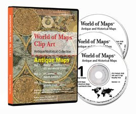
This new collection of over 125 royalty free, jpg maps on 3 CD-ROMs is made up of antique and vintage maps from the 1500s to the 1900s. It includes; World, North America, South America, Europe, Africa, Asia, Middle East, some Countries, Cities and States, and United States maps.

These maps are perfect for presentations, graphic design, illustrations, web sites and education projects.

Our new collection of royalty free, jpg, clip art Antique and Historical Maps will release on Tuesday, July 15, Yea!!!.

Because this release is so special we will also be including for a limited time several Free Bonuses with the collection. Pulling from some of our other collections are more royalty free jpg maps including;

• over 300 CIA country and regional maps

• over 250 World Fact Book Maps and Flags.

• Plus several hundred jpg and Adobe Illustrator eps maps from our own World of Maps collection. Including World, US, States, County, World Region, Country and Globes.

• We might even have a really, really special bonus coming, details to come

Making for a fantastic collection of royalty free maps from today and yesterday.

So watch your emails and the web site for more detailed info on the July 15 release of our Antique and Historical vintage clip art collection. Pricing info coming on Thursday, July 10th.

http://antiquehistoricalmaps.blogspot.com/

Thank you Bruce Jones


P.S. Be sure to sign up on the mailing list to get free hi-res Antique Map samples and download the free pdf directories of every map in the collection.

Sign up at http://antiquehistoricalmaps.blogspot.com/

Wednesday, July 2, 2008

We are publishing a book on our travels in the US can we use your maps to illustrate?

Today's question on use of our royalty free maps.

Thank you for visiting our site and for your question. No problem at all. Our maps are royalty free and can be used in publications or for building a web site. No additional cost involved once you make the initial purchase.

If you only need a couple of maps then the www.MapsforDesign.com site will work great. If you need lots, like each state, we also have a subscription site where you can download any and all of our maps for $149.95 for a year of access. Take a look at http://www.bjdesign.com.

This would save you some money if you need more than three or so. You can also purchase the CD-Rom.

I would also check what you need to edit the maps. Publications usually want eps files from Adobe Illustrator so you would use our editable eps format maps and customize them in Illustrator. But you would need Adobe Illustrator on your computer.

You can also do some of this in PowerPoint and save the files as jpg, this is sort of the cheap way of doing it. I would check with your publisher first on how they want the graphics. Either way we have lots of maps that would work and they are ready to go.

thank you for asking and if you have any questions please contact me

bruce jones

Tuesday, July 1, 2008

Wondering if you are able to offer an editable maps of the United Kingdom by Postal District

> We get this question on and off about zip and postal code maps, this
> one is from the United Kingdom.

Thank you for visiting our site and for your question. We haven't drawn
any maps along postal district lines, they are much tougher to deal
with and change quite often and aren't requested that often. Also there
isn't any readily available source for the info like there is for
county and country maps.

I usually recommend people to www.creativeforceinc.com and also to

www.zipcodemaps.com, but I don't think they have powerpoint maps and am
not sure about maps for the UK, but they are a place to start. If you
are using Adobe Illustrator you can also check out

www.mapresources.com, they have some 3 digit postal maps Getting this
kind of info especially for countries other than the US is often quite
hard. It took a year to get the license from your government for the UK
district administration map that we sell.

I might also check out www.mapinfo.com they are the main company for
plotting data on a map for major consumer companies analyzing their
marketing efforts. They do go down to the street level and zip and
postal codes play a much bigger roll in that area. Also check out

www.territorymapper.com, they are a cheaper alternative that many of my
customers use.

I might also check with your local county planning board, they very
often have electronic maps for city planning and it might work for your
needs.

hope this help, bruce jones

Thursday, June 26, 2008

10 Tips for Adobe Illustrator

Hi Maps for Design users, this just came across our desk from
Shutterstock.com, the royalty free photo site. It is on 10 tips for
using Adobe Illustrator.

Including:
1. Learn the Keyboard Shortcuts
2, Copy in Place
3. Option/Alt and Shift Drag
4. Learn the Smart Guides
5. Flatten Transparency
6. Group Items to Move Them (I am always recommending this to our
customers, great tip)
7. Transform Again
8. Blend Shapes
9. Work with Text Boxes
10. Changing a Star to a Triangle

Check out all the info at:

http://www.shutterstock.com/newsletter/49/article3.html

Wednesday, June 18, 2008

Adding Cities to PowerPoint Maps

Question: I want to add several cities to one of your maps. The cities
are Madrid, Toledo, Avila, Segovia, Sevilla, Cordova, Granada,
Barcelona. How do I do this

Answer: Thank you for visiting our site and for your question. If you
are using our PowerPoint editable maps you can easily add in what ever
text you might need. The maps are completely editable. Just use the
text tool and type your city on the edge somewhere, format it to the
size and font that you want. Then using the pointer move it to the
correct location. I would also add in a little circle or square to mark
the city, For the cities you mentioned you could use the Europe map.

check out this link for map
http://www.mapsfordesign.com/shop/product.php?

productid=16257&cat=253&page=2

We also put together a video on this.
http://mapsfordesignhowto.blogspot.com/2008/03/how-to-add-text-to-

powerpoint-slide.html

Hope this answers your question
thank you.
bruce jones

Thursday, June 12, 2008

How to Split a State in Half

We get this question all the time and just wanted to revisit the topic
and to highlight all of our How To Videos for customizing our
PowerPoint Maps.

We have produced a series of videos on how to customize your maps.
Please contact me if you are still stuck, and I will try to help. The
video covers it pretty well

Please click on the link below for How to Split a State
http://mapsfordesignhowto.blogspot.com/2008/03/how-to-divide-

powerpoint-clipart-map-in.html

Please click on this link for all of our How to Video
http://mapsfordesignhowto.blogspot.com/

thank you, bruce jones

Thursday, June 5, 2008

USA Map to Track the Election

Question: I want to get a US map of the 50 states that I can download
and that I can color to show which states are likely to go Republican
in November, which are likely to go Democratic and which are "swing"
states. What do you have?

Answer: thank you for visiting our site and for your question. We have
two editable USA maps in PowerPoint that would work for you. The
difference is one has two letter state names and the other has the full
name. Both are fully editable with each state an individual element
that you can color using the fill bucket in the Drawing Bar. For the
swing states you can use the pattern fill in the paint bucket and
choose a two color pattern. Should work just fine. Click on the link
below to review the maps

http://www.mapsfordesign.com/shop/home.php?cat=249

Just register on the site and order the map. You will be able to
download it right after the order form processes.

Any questions please contact me and I can help
thank you, bruce jones

Monday, June 2, 2008

I wanted to know if you can create maps with only the states or countries you want?

Question: I wanted to know if you can create maps with only the states
or countries you want

Answer: Thank you for visiting our site and for your question. Yes you
can, wither you are working in PowerPoint or Illustrator you can create
a custom map. All of the states, counties or countries are individual
elements that can be customized, colored, deleted, moved around, what
ever you want to do.

If you wanted to set up just the Pacific Northwest say, just delete the
other states, move the remaining ones to the center of the screen and
there you go, a custom territory. All pretty easy.

Hope this helps, let me know if you have further questions.

thank you, bruce jones